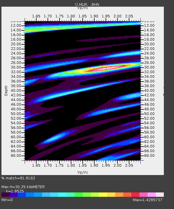
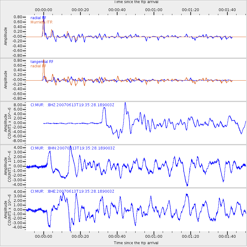
MUR Murrieta - Earthquake Result Viewer

Earthquake location: Near Coast Of Guatemala
Earthquake latitude/longitude: 13.6/-90.6
Earthquake time(UTC): 2007/06/13 (164) 19:29:40 GMT
Earthquake Depth: 23 km
Earthquake Magnitude: 5.9 MB, 6.5 MS, 6.7 MW, 6.5 MW
Earthquake Catalog/Contributor: WHDF/NEIC
Network: CI Caltech Regional Seismic Network
Station: MUR Murrieta
Lat/Lon: 33.60 N/117.20 W
Elevation: 562 m
Distance: 31.3 deg
Az: 314.098 deg
Baz: 123.198 deg
Ray Param: 0.079081096
Estimated Moho Depth: 30.25 km
Estimated Crust Vp/Vs: 1.95
Assumed Crust Vp: 6.264 km/s
Estimated Crust Vs: 3.208 km/s
Estimated Crust Poisson's Ratio: 0.32
Radial Match: 91.9182 %
Radial Bump: 381
Transverse Match: 79.411316 %
Transverse Bump: 400
SOD ConfigId: 2564
Insert Time: 2010-03-05 21:15:48.839 +0000
GWidth: 2.5
Max Bumps: 400
Tol: 0.001

Signal To Noise

ChannelStoNSTALTA
CI:MUR: :BHN:20070613T19:35:28.189003Z11.4876371.5267152E-61.3290072E-7
CI:MUR: :BHE:20070613T19:35:28.189003Z9.394841.7771852E-61.8916607E-7
CI:MUR: :BHZ:20070613T19:35:28.189003Z34.7957953.4492168E-69.91274E-8
Arrivals
Ps4.9 SECOND
PpPs13 SECOND
PsPs/PpSs18 SECOND