MUR Murrieta - Earthquake Result Viewer
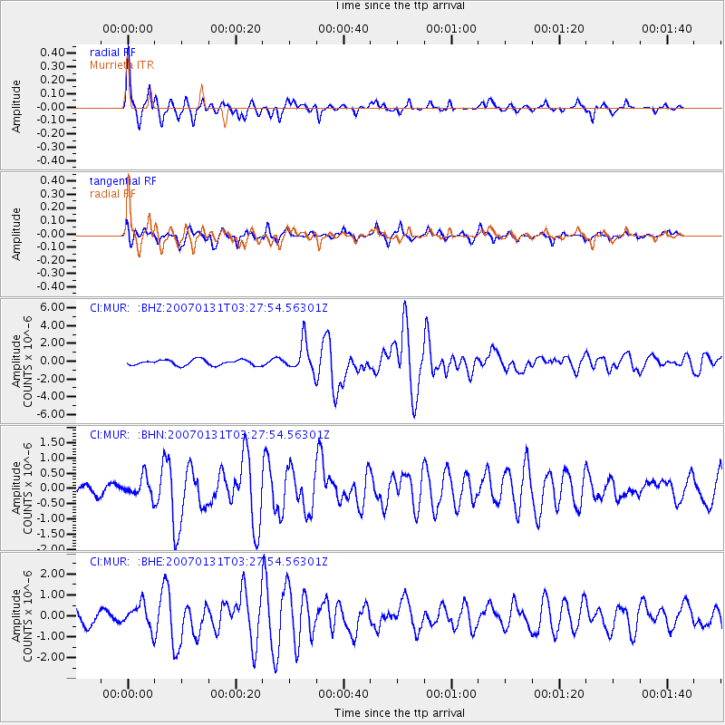
Earthquake location: Kermadec Islands, New Zealand
Earthquake latitude/longitude: -29.8/-178.0
Earthquake time(UTC): 2007/01/31 (031) 03:15:52 GMT
Earthquake Depth: 34 km
Earthquake Magnitude: 6.1 MB, 6.3 MS, 6.5 MW, 6.4 MW
Earthquake Catalog/Contributor: WHDF/NEIC
Network: CI Caltech Regional Seismic Network
Station: MUR Murrieta
Lat/Lon: 33.60 N/117.20 W
Elevation: 562 m
Distance: 85.3 deg
Az: 46.975 deg
Baz: 229.599 deg
Ray Param: 0.044811435
Estimated Moho Depth: 22.5 km
Estimated Crust Vp/Vs: 2.09
Assumed Crust Vp: 6.264 km/s
Estimated Crust Vs: 2.997 km/s
Estimated Crust Poisson's Ratio: 0.35
Radial Match: 93.38565 %
Radial Bump: 312
Transverse Match: 82.91158 %
Transverse Bump: 346
SOD ConfigId: 2564
Insert Time: 2010-03-05 21:16:05.860 +0000
GWidth: 2.5
Max Bumps: 400
Tol: 0.001

Signal To Noise

ChannelStoNSTALTA
CI:MUR: :BHN:20070131T03:27:54.56301Z1.71744693.247335E-71.890792E-7
CI:MUR: :BHE:20070131T03:27:54.56301Z1.53637715.753335E-73.7447415E-7
CI:MUR: :BHZ:20070131T03:27:54.56301Z5.4305681.6805214E-63.094559E-7
Arrivals
Ps4.0 SECOND
PpPs11 SECOND
PsPs/PpSs15 SECOND