You are here: Home > Network List > TA - USArray Transportable Network (new EarthScope stations) Stations List
> Station L20K Farewell, AK, USA > Earthquake Result Viewer
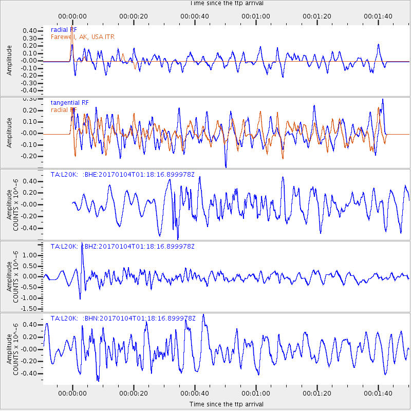
L20K Farewell, AK, USA - Earthquake Result Viewer
*The percent match for this event was below the threshold and hence no stack was calculated.
| Earthquake location: |
Vanuatu Islands |
| Earthquake latitude/longitude: |
-17.9/167.1 |
| Earthquake time(UTC): |
2017/01/04 (004) 01:06:10 GMT |
| Earthquake Depth: |
15 km |
| Earthquake Magnitude: |
5.7 mb |
| Earthquake Catalog/Contributor: |
NEIC PDE/us |
|
| Network: |
TA USArray Transportable Network (new EarthScope stations) |
| Station: |
L20K Farewell, AK, USA |
| Lat/Lon: |
62.48 N/153.88 W |
| Elevation: |
673 m |
|
| Distance: |
85.8 deg |
| Az: |
17.04 deg |
| Baz: |
216.927 deg |
| Ray Param: |
$rayparam |
*The percent match for this event was below the threshold and hence was not used in the summary stack. |
|
| Radial Match: |
71.303276 % |
| Radial Bump: |
384 |
| Transverse Match: |
51.366783 % |
| Transverse Bump: |
400 |
| SOD ConfigId: |
11737051 |
| Insert Time: |
2019-04-26 13:09:56.753 +0000 |
| GWidth: |
2.5 |
| Max Bumps: |
400 |
| Tol: |
0.001 |
|
Signal To Noise
| Channel | StoN | STA | LTA |
| TA:L20K: :BHZ:20170104T01:18:16.899978Z | 1.9877621 | 5.526958E-7 | 2.7804924E-7 |
| TA:L20K: :BHN:20170104T01:18:16.899978Z | 0.7290821 | 2.0956571E-7 | 2.8743776E-7 |
| TA:L20K: :BHE:20170104T01:18:16.899978Z | 2.0648746 | 3.1231255E-7 | 1.5125013E-7 |
| Arrivals |
| Ps | |
| PpPs | |
| PsPs/PpSs | |


