MUR Murrieta - Earthquake Result Viewer
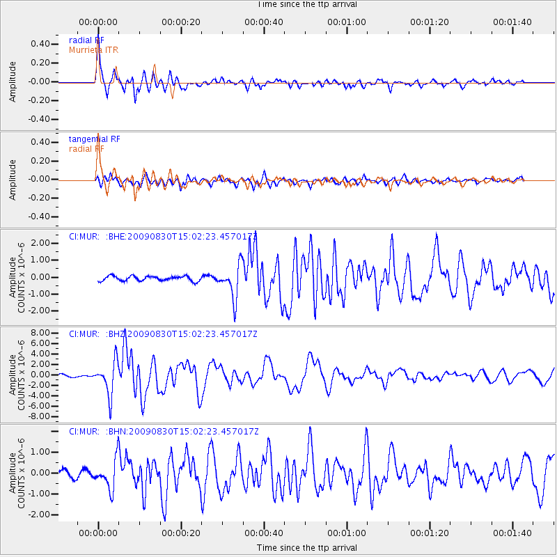
Earthquake location: Samoa Islands Region
Earthquake latitude/longitude: -15.2/-172.6
Earthquake time(UTC): 2009/08/30 (242) 14:51:32 GMT
Earthquake Depth: 11 km
Earthquake Magnitude: 6.4 MB, 6.3 MS, 6.6 MW, 6.6 MW
Earthquake Catalog/Contributor: WHDF/NEIC
Network: CI Caltech Regional Seismic Network
Station: MUR Murrieta
Lat/Lon: 33.60 N/117.20 W
Elevation: 562 m
Distance: 71.7 deg
Az: 46.337 deg
Baz: 236.796 deg
Ray Param: 0.054154437
Estimated Moho Depth: 25.0 km
Estimated Crust Vp/Vs: 1.84
Assumed Crust Vp: 6.264 km/s
Estimated Crust Vs: 3.409 km/s
Estimated Crust Poisson's Ratio: 0.29
Radial Match: 95.017654 %
Radial Bump: 400
Transverse Match: 82.22576 %
Transverse Bump: 400
SOD ConfigId: 2622
Insert Time: 2010-03-05 21:16:26.399 +0000
GWidth: 2.5
Max Bumps: 400
Tol: 0.001

Signal To Noise

ChannelStoNSTALTA
CI:MUR: :BHZ:20090830T15:02:23.457017Z13.86233.293763E-62.376058E-7
CI:MUR: :BHN:20090830T15:02:23.457017Z4.53912977.402356E-71.6307874E-7
CI:MUR: :BHE:20090830T15:02:23.457017Z7.1092711.0084784E-61.4185399E-7
Arrivals
Ps3.5 SECOND
PpPs11 SECOND
PsPs/PpSs14 SECOND