MUR Murrieta - Earthquake Result Viewer
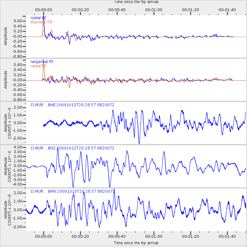
Earthquake location: Fox Islands, Aleutian Islands
Earthquake latitude/longitude: 52.6/-167.1
Earthquake time(UTC): 2009/10/13 (286) 20:21:53 GMT
Earthquake Depth: 14 km
Earthquake Magnitude: 5.9 MB, 6.4 MS, 6.4 MW, 6.4 MW
Earthquake Catalog/Contributor: WHDF/NEIC
Network: CI Caltech Regional Seismic Network
Station: MUR Murrieta
Lat/Lon: 33.60 N/117.20 W
Elevation: 562 m
Distance: 40.2 deg
Az: 98.013 deg
Baz: 313.647 deg
Ray Param: 0.074541844
Estimated Moho Depth: 22.5 km
Estimated Crust Vp/Vs: 2.04
Assumed Crust Vp: 6.264 km/s
Estimated Crust Vs: 3.07 km/s
Estimated Crust Poisson's Ratio: 0.34
Radial Match: 92.85434 %
Radial Bump: 400
Transverse Match: 75.64042 %
Transverse Bump: 400
SOD ConfigId: 2622
Insert Time: 2010-03-05 21:16:49.380 +0000
GWidth: 2.5
Max Bumps: 400
Tol: 0.001

Signal To Noise

ChannelStoNSTALTA
CI:MUR: :BHZ:20091013T20:28:57.882007Z5.0265838.5778146E-71.7064902E-7
CI:MUR: :BHN:20091013T20:28:57.882007Z1.58272495.0161503E-73.1693128E-7
CI:MUR: :BHE:20091013T20:28:57.882007Z1.55239993.2045023E-72.0642247E-7
Arrivals
Ps4.0 SECOND
PpPs10 SECOND
PsPs/PpSs14 SECOND