MUR Murrieta - Earthquake Result Viewer
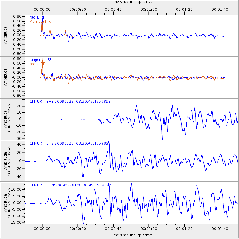
Earthquake location: North Of Honduras
Earthquake latitude/longitude: 16.7/-86.2
Earthquake time(UTC): 2009/05/28 (148) 08:24:45 GMT
Earthquake Depth: 10 km
Earthquake Magnitude: 6.7 MB, 7.2 MS, 7.3 MW, 7.3 MW
Earthquake Catalog/Contributor: WHDF/NEIC
Network: CI Caltech Regional Seismic Network
Station: MUR Murrieta
Lat/Lon: 33.60 N/117.20 W
Elevation: 562 m
Distance: 32.5 deg
Az: 306.967 deg
Baz: 113.461 deg
Ray Param: 0.078621715
Estimated Moho Depth: 30.25 km
Estimated Crust Vp/Vs: 1.88
Assumed Crust Vp: 6.264 km/s
Estimated Crust Vs: 3.327 km/s
Estimated Crust Poisson's Ratio: 0.30
Radial Match: 93.80949 %
Radial Bump: 366
Transverse Match: 89.45028 %
Transverse Bump: 400
SOD ConfigId: 2648
Insert Time: 2010-03-05 21:16:56.585 +0000
GWidth: 2.5
Max Bumps: 400
Tol: 0.001

Signal To Noise

ChannelStoNSTALTA
CI:MUR: :BHZ:20090528T08:30:45.155989Z28.9501176.082377E-62.1009852E-7
CI:MUR: :BHN:20090528T08:30:45.155989Z18.882642.0154657E-61.0673644E-7
CI:MUR: :BHE:20090528T08:30:45.155989Z26.7703463.4137292E-61.2751906E-7
Arrivals
Ps4.6 SECOND
PpPs13 SECOND
PsPs/PpSs18 SECOND