You are here: Home > Network List > TA - USArray Transportable Network (new EarthScope stations) Stations List
> Station J26L Joseph Creek, AK, USA > Earthquake Result Viewer
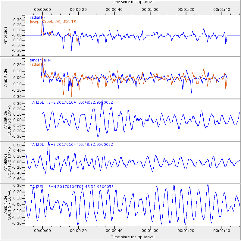
J26L Joseph Creek, AK, USA - Earthquake Result Viewer
*The percent match for this event was below the threshold and hence no stack was calculated.
| Earthquake location: |
South Of Fiji Islands |
| Earthquake latitude/longitude: |
-19.2/176.0 |
| Earthquake time(UTC): |
2017/01/04 (004) 05:36:09 GMT |
| Earthquake Depth: |
10 km |
| Earthquake Magnitude: |
5.5 mb |
| Earthquake Catalog/Contributor: |
NEIC PDE/us |
|
| Network: |
TA USArray Transportable Network (new EarthScope stations) |
| Station: |
J26L Joseph Creek, AK, USA |
| Lat/Lon: |
64.50 N/143.56 W |
| Elevation: |
1144 m |
|
| Distance: |
89.0 deg |
| Az: |
16.298 deg |
| Baz: |
217.797 deg |
| Ray Param: |
$rayparam |
*The percent match for this event was below the threshold and hence was not used in the summary stack. |
|
| Radial Match: |
75.37735 % |
| Radial Bump: |
360 |
| Transverse Match: |
58.355106 % |
| Transverse Bump: |
343 |
| SOD ConfigId: |
11737051 |
| Insert Time: |
2019-04-26 13:17:01.106 +0000 |
| GWidth: |
2.5 |
| Max Bumps: |
400 |
| Tol: |
0.001 |
|
Signal To Noise
| Channel | StoN | STA | LTA |
| TA:J26L: :BHZ:20170104T05:48:32.950005Z | 1.5242352 | 3.0794783E-7 | 2.0203431E-7 |
| TA:J26L: :BHN:20170104T05:48:32.950005Z | 1.5668333 | 1.3759306E-7 | 8.781603E-8 |
| TA:J26L: :BHE:20170104T05:48:32.950005Z | 2.0678844 | 2.0528455E-7 | 9.927274E-8 |
| Arrivals |
| Ps | |
| PpPs | |
| PsPs/PpSs | |


