You are here: Home > Network List > TA - USArray Transportable Network (new EarthScope stations) Stations List
> Station L19K White Mountain, AK, USA > Earthquake Result Viewer
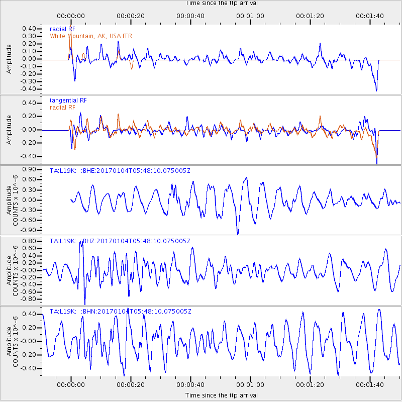
L19K White Mountain, AK, USA - Earthquake Result Viewer
*The percent match for this event was below the threshold and hence no stack was calculated.
| Earthquake location: |
South Of Fiji Islands |
| Earthquake latitude/longitude: |
-19.2/176.0 |
| Earthquake time(UTC): |
2017/01/04 (004) 05:36:09 GMT |
| Earthquake Depth: |
10 km |
| Earthquake Magnitude: |
5.5 mb |
| Earthquake Catalog/Contributor: |
NEIC PDE/us |
|
| Network: |
TA USArray Transportable Network (new EarthScope stations) |
| Station: |
L19K White Mountain, AK, USA |
| Lat/Lon: |
62.18 N/154.85 W |
| Elevation: |
650 m |
|
| Distance: |
84.3 deg |
| Az: |
13.263 deg |
| Baz: |
207.534 deg |
| Ray Param: |
$rayparam |
*The percent match for this event was below the threshold and hence was not used in the summary stack. |
|
| Radial Match: |
61.033592 % |
| Radial Bump: |
397 |
| Transverse Match: |
45.962006 % |
| Transverse Bump: |
400 |
| SOD ConfigId: |
11737051 |
| Insert Time: |
2019-04-26 13:17:03.050 +0000 |
| GWidth: |
2.5 |
| Max Bumps: |
400 |
| Tol: |
0.001 |
|
Signal To Noise
| Channel | StoN | STA | LTA |
| TA:L19K: :BHZ:20170104T05:48:10.075005Z | 2.4263074 | 4.732727E-7 | 1.9505885E-7 |
| TA:L19K: :BHN:20170104T05:48:10.075005Z | 1.0099442 | 1.8570633E-7 | 1.8387782E-7 |
| TA:L19K: :BHE:20170104T05:48:10.075005Z | 1.2315886 | 2.7868825E-7 | 2.2628356E-7 |
| Arrivals |
| Ps | |
| PpPs | |
| PsPs/PpSs | |


