You are here: Home > Network List > UW - Pacific Northwest Regional Seismic Network Stations List
> Station UMAT Pilot Rock, OR, USA > Earthquake Result Viewer
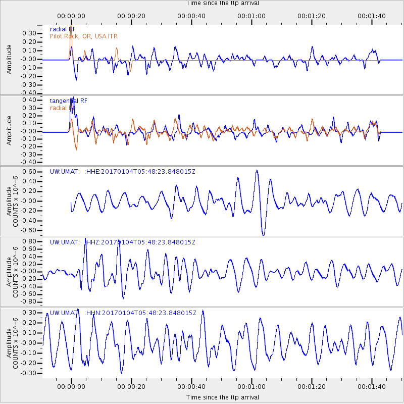
UMAT Pilot Rock, OR, USA - Earthquake Result Viewer
*The percent match for this event was below the threshold and hence no stack was calculated.
| Earthquake location: |
South Of Fiji Islands |
| Earthquake latitude/longitude: |
-19.2/176.0 |
| Earthquake time(UTC): |
2017/01/04 (004) 05:36:09 GMT |
| Earthquake Depth: |
10 km |
| Earthquake Magnitude: |
5.5 mb |
| Earthquake Catalog/Contributor: |
NEIC PDE/us |
|
| Network: |
UW Pacific Northwest Regional Seismic Network |
| Station: |
UMAT Pilot Rock, OR, USA |
| Lat/Lon: |
45.29 N/118.96 W |
| Elevation: |
1318 m |
|
| Distance: |
87.1 deg |
| Az: |
39.841 deg |
| Baz: |
239.083 deg |
| Ray Param: |
$rayparam |
*The percent match for this event was below the threshold and hence was not used in the summary stack. |
|
| Radial Match: |
51.008522 % |
| Radial Bump: |
400 |
| Transverse Match: |
57.672474 % |
| Transverse Bump: |
382 |
| SOD ConfigId: |
11737051 |
| Insert Time: |
2019-04-26 13:17:54.860 +0000 |
| GWidth: |
2.5 |
| Max Bumps: |
400 |
| Tol: |
0.001 |
|
Signal To Noise
| Channel | StoN | STA | LTA |
| UW:UMAT: :HHZ:20170104T05:48:23.848015Z | 2.0911157 | 2.8913516E-7 | 1.3826838E-7 |
| UW:UMAT: :HHN:20170104T05:48:23.848015Z | 0.9673846 | 2.0740612E-7 | 2.1439882E-7 |
| UW:UMAT: :HHE:20170104T05:48:23.848015Z | 1.4568924 | 1.7576183E-7 | 1.206416E-7 |
| Arrivals |
| Ps | |
| PpPs | |
| PsPs/PpSs | |


