MUR Murrieta - Earthquake Result Viewer
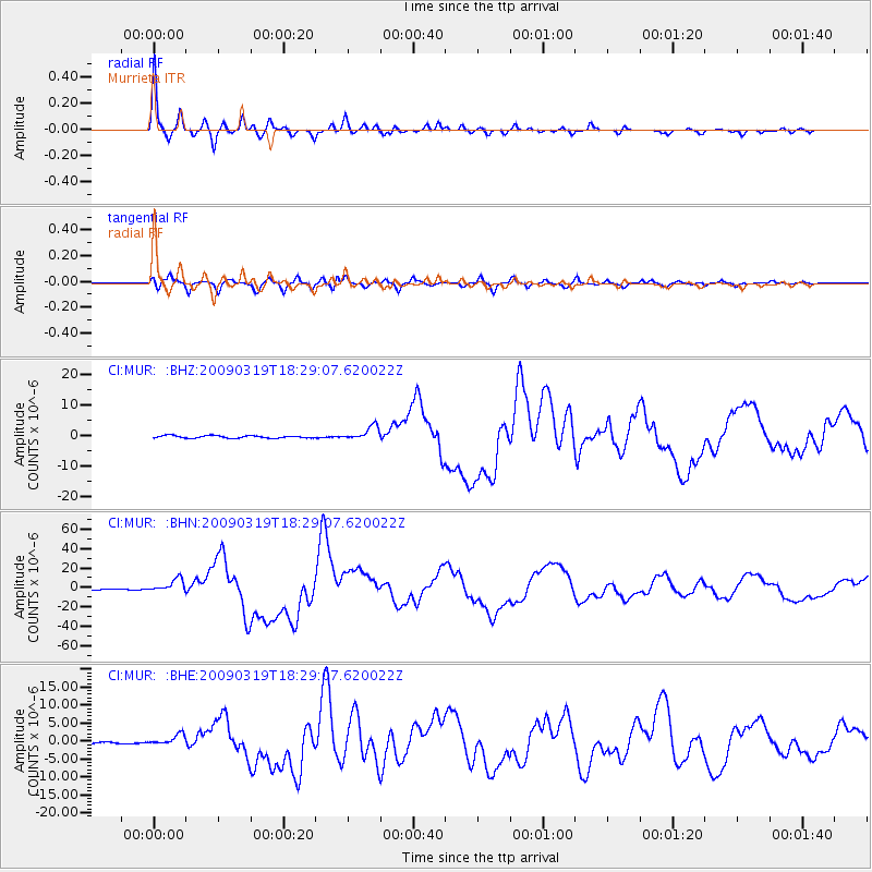
Earthquake location: Tonga Islands Region
Earthquake latitude/longitude: -23.0/-174.7
Earthquake time(UTC): 2009/03/19 (078) 18:17:40 GMT
Earthquake Depth: 34 km
Earthquake Magnitude: 7.0 MB, 7.6 MS, 7.6 MW, 7.6 MW
Earthquake Catalog/Contributor: WHDF/NEIC
Network: CI Caltech Regional Seismic Network
Station: MUR Murrieta
Lat/Lon: 33.60 N/117.20 W
Elevation: 562 m
Distance: 78.5 deg
Az: 45.89 deg
Baz: 232.413 deg
Ray Param: 0.04954021
Estimated Moho Depth: 44.75 km
Estimated Crust Vp/Vs: 1.60
Assumed Crust Vp: 6.264 km/s
Estimated Crust Vs: 3.915 km/s
Estimated Crust Poisson's Ratio: 0.18
Radial Match: 98.0568 %
Radial Bump: 306
Transverse Match: 88.67187 %
Transverse Bump: 400
SOD ConfigId: 2658
Insert Time: 2010-03-05 21:17:26.554 +0000
GWidth: 2.5
Max Bumps: 400
Tol: 0.001

Signal To Noise

ChannelStoNSTALTA
CI:MUR: :BHN:20090319T18:29:07.620022Z10.5758336.791636E-66.421845E-7
CI:MUR: :BHE:20090319T18:29:07.620022Z2.71161961.5138406E-65.582791E-7
CI:MUR: :BHZ:20090319T18:29:07.620022Z5.64542442.3228379E-64.1145498E-7
Arrivals
Ps4.4 SECOND
PpPs18 SECOND
PsPs/PpSs22 SECOND