MUR Murrieta - Earthquake Result Viewer
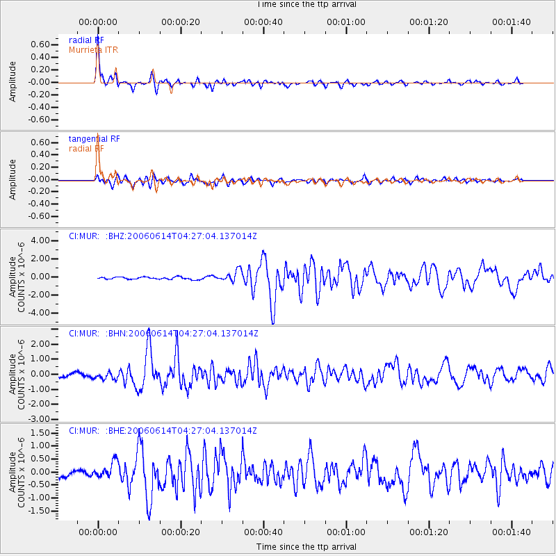
Earthquake location: Rat Islands, Aleutian Islands
Earthquake latitude/longitude: 51.8/177.1
Earthquake time(UTC): 2006/06/14 (165) 04:18:42 GMT
Earthquake Depth: 14 km
Earthquake Magnitude: 5.9 MB, 6.4 MS, 6.4 MW, 6.4 MW
Earthquake Catalog/Contributor: WHDF/NEIC
Network: CI Caltech Regional Seismic Network
Station: MUR Murrieta
Lat/Lon: 33.60 N/117.20 W
Elevation: 562 m
Distance: 49.9 deg
Az: 84.475 deg
Baz: 312.155 deg
Ray Param: 0.06842792
Estimated Moho Depth: 21.75 km
Estimated Crust Vp/Vs: 2.10
Assumed Crust Vp: 6.264 km/s
Estimated Crust Vs: 2.986 km/s
Estimated Crust Poisson's Ratio: 0.35
Radial Match: 93.380936 %
Radial Bump: 333
Transverse Match: 80.61644 %
Transverse Bump: 400
SOD ConfigId: 5745
Insert Time: 2010-03-05 21:17:54.609 +0000
GWidth: 2.5
Max Bumps: 400
Tol: 0.001

Signal To Noise

ChannelStoNSTALTA
CI:MUR: :BHN:20060614T04:27:04.137014Z2.06586532.3413313E-71.1333417E-7
CI:MUR: :BHE:20060614T04:27:04.137014Z2.3342733.3006526E-71.413996E-7
CI:MUR: :BHZ:20060614T04:27:04.137014Z5.1052936.560711E-71.2850803E-7
Arrivals
Ps4.0 SECOND
PpPs10 SECOND
PsPs/PpSs14 SECOND