You are here: Home > Network List > CI - Caltech Regional Seismic Network Stations List
> Station MUR Murrieta > Earthquake Result Viewer
MUR Murrieta - Earthquake Result Viewer
*The percent match for this event was below the threshold and hence no stack was calculated.
| Earthquake location: |
Fiji Islands Region |
| Earthquake latitude/longitude: |
-17.3/-177.3 |
| Earthquake time(UTC): |
2008/07/19 (201) 22:39:52 GMT |
| Earthquake Depth: |
391 km |
| Earthquake Magnitude: |
5.9 MB, 6.4 MW, 6.4 MW |
| Earthquake Catalog/Contributor: |
WHDF/NEIC |
|
| Network: |
CI Caltech Regional Seismic Network |
| Station: |
MUR Murrieta |
| Lat/Lon: |
33.60 N/117.20 W |
| Elevation: |
562 m |
|
| Distance: |
76.5 deg |
| Az: |
48.102 deg |
| Baz: |
238.408 deg |
| Ray Param: |
$rayparam |
*The percent match for this event was below the threshold and hence was not used in the summary stack. |
|
| Radial Match: |
77.628914 % |
| Radial Bump: |
400 |
| Transverse Match: |
64.01018 % |
| Transverse Bump: |
400 |
| SOD ConfigId: |
2504 |
| Insert Time: |
2010-03-05 21:18:16.705 +0000 |
| GWidth: |
2.5 |
| Max Bumps: |
400 |
| Tol: |
0.001 |
|
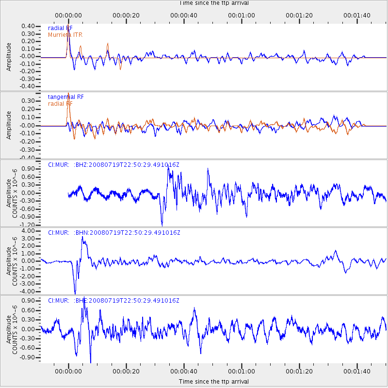
Signal To Noise
| Channel | StoN | STA | LTA |
| CI:MUR: :BHN:20080719T22:50:29.491016Z | 9.692565 | 1.7163482E-6 | 1.7707885E-7 |
| CI:MUR: :BHE:20080719T22:50:29.491016Z | 2.2247436 | 3.6093505E-7 | 1.622367E-7 |
| CI:MUR: :BHZ:20080719T22:50:29.491016Z | 3.855656 | 5.074418E-7 | 1.3160972E-7 |
| Arrivals |
| Ps | |
| PpPs | |
| PsPs/PpSs | |


