You are here: Home > Network List > CI - Caltech Regional Seismic Network Stations List
> Station MUR Murrieta > Earthquake Result Viewer
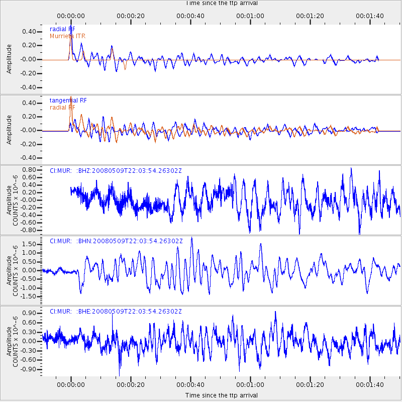
MUR Murrieta - Earthquake Result Viewer
*The percent match for this event was below the threshold and hence no stack was calculated.
| Earthquake location: |
South Of Mariana Islands |
| Earthquake latitude/longitude: |
12.5/143.2 |
| Earthquake time(UTC): |
2008/05/09 (130) 21:51:29 GMT |
| Earthquake Depth: |
76 km |
| Earthquake Magnitude: |
6.1 MB, 6.7 MW, 6.7 MW |
| Earthquake Catalog/Contributor: |
WHDF/NEIC |
|
| Network: |
CI Caltech Regional Seismic Network |
| Station: |
MUR Murrieta |
| Lat/Lon: |
33.60 N/117.20 W |
| Elevation: |
562 m |
|
| Distance: |
91.0 deg |
| Az: |
55.387 deg |
| Baz: |
285.645 deg |
| Ray Param: |
$rayparam |
*The percent match for this event was below the threshold and hence was not used in the summary stack. |
|
| Radial Match: |
71.37282 % |
| Radial Bump: |
393 |
| Transverse Match: |
70.4298 % |
| Transverse Bump: |
400 |
| SOD ConfigId: |
2504 |
| Insert Time: |
2010-03-05 21:18:28.213 +0000 |
| GWidth: |
2.5 |
| Max Bumps: |
400 |
| Tol: |
0.001 |
|
Signal To Noise
| Channel | StoN | STA | LTA |
| CI:MUR: :BHN:20080509T22:03:54.26302Z | 3.9145553 | 4.9218136E-7 | 1.257311E-7 |
| CI:MUR: :BHE:20080509T22:03:54.26302Z | 1.3835602 | 2.7365962E-7 | 1.977938E-7 |
| CI:MUR: :BHZ:20080509T22:03:54.26302Z | 1.5459921 | 3.0120043E-7 | 1.9482661E-7 |
| Arrivals |
| Ps | |
| PpPs | |
| PsPs/PpSs | |


