You are here: Home > Network List > TA - USArray Transportable Network (new EarthScope stations) Stations List
> Station D23K Nanushuk River, AK USA > Earthquake Result Viewer
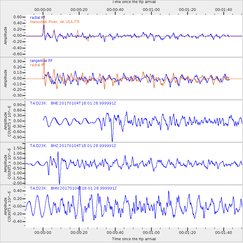
D23K Nanushuk River, AK USA - Earthquake Result Viewer
*The percent match for this event was below the threshold and hence no stack was calculated.
| Earthquake location: |
Near East Coast Of Honshu, Japan |
| Earthquake latitude/longitude: |
37.1/141.3 |
| Earthquake time(UTC): |
2017/01/04 (004) 17:53:20 GMT |
| Earthquake Depth: |
10 km |
| Earthquake Magnitude: |
5.6 mb |
| Earthquake Catalog/Contributor: |
NEIC PDE/us |
|
| Network: |
TA USArray Transportable Network (new EarthScope stations) |
| Station: |
D23K Nanushuk River, AK USA |
| Lat/Lon: |
68.97 N/150.68 W |
| Elevation: |
406 m |
|
| Distance: |
48.0 deg |
| Az: |
26.754 deg |
| Baz: |
265.183 deg |
| Ray Param: |
$rayparam |
*The percent match for this event was below the threshold and hence was not used in the summary stack. |
|
| Radial Match: |
51.8767 % |
| Radial Bump: |
332 |
| Transverse Match: |
54.166325 % |
| Transverse Bump: |
400 |
| SOD ConfigId: |
11737051 |
| Insert Time: |
2019-04-26 13:26:05.447 +0000 |
| GWidth: |
2.5 |
| Max Bumps: |
400 |
| Tol: |
0.001 |
|
Signal To Noise
| Channel | StoN | STA | LTA |
| TA:D23K: :BHZ:20170104T18:01:28.999991Z | 3.62259 | 4.2015841E-7 | 1.1598288E-7 |
| TA:D23K: :BHN:20170104T18:01:28.999991Z | 1.188072 | 1.9789428E-7 | 1.665676E-7 |
| TA:D23K: :BHE:20170104T18:01:28.999991Z | 1.2751099 | 1.8700558E-7 | 1.4665841E-7 |
| Arrivals |
| Ps | |
| PpPs | |
| PsPs/PpSs | |


