You are here: Home > Network List > CI - Caltech Regional Seismic Network Stations List
> Station MUR Murrieta > Earthquake Result Viewer
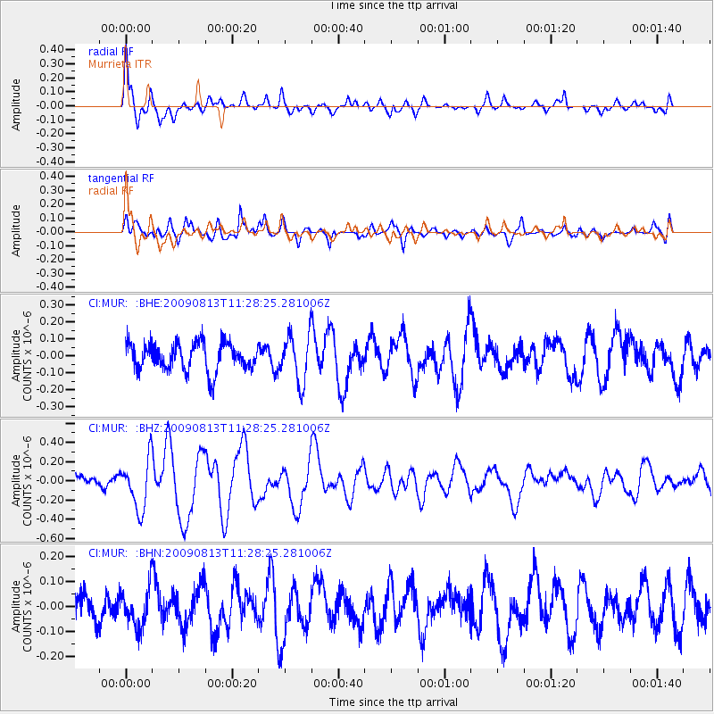
MUR Murrieta - Earthquake Result Viewer
*The percent match for this event was below the threshold and hence no stack was calculated.
| Earthquake location: |
Tonga Islands |
| Earthquake latitude/longitude: |
-21.7/-174.6 |
| Earthquake time(UTC): |
2009/08/13 (225) 11:17:01 GMT |
| Earthquake Depth: |
10 km |
| Earthquake Magnitude: |
5.6 MW, 5.3 MB |
| Earthquake Catalog/Contributor: |
WHDF/NEIC |
|
| Network: |
CI Caltech Regional Seismic Network |
| Station: |
MUR Murrieta |
| Lat/Lon: |
33.60 N/117.20 W |
| Elevation: |
562 m |
|
| Distance: |
77.5 deg |
| Az: |
46.052 deg |
| Baz: |
233.363 deg |
| Ray Param: |
$rayparam |
*The percent match for this event was below the threshold and hence was not used in the summary stack. |
|
| Radial Match: |
78.83053 % |
| Radial Bump: |
400 |
| Transverse Match: |
68.875145 % |
| Transverse Bump: |
400 |
| SOD ConfigId: |
2622 |
| Insert Time: |
2010-03-05 21:18:46.635 +0000 |
| GWidth: |
2.5 |
| Max Bumps: |
400 |
| Tol: |
0.001 |
|
Signal To Noise
| Channel | StoN | STA | LTA |
| CI:MUR: :BHZ:20090813T11:28:25.281006Z | 3.2324538 | 2.646164E-7 | 8.186239E-8 |
| CI:MUR: :BHN:20090813T11:28:25.281006Z | 1.2034396 | 7.677564E-8 | 6.379684E-8 |
| CI:MUR: :BHE:20090813T11:28:25.281006Z | 1.7735294 | 1.4243705E-7 | 8.031276E-8 |
| Arrivals |
| Ps | |
| PpPs | |
| PsPs/PpSs | |


