You are here: Home > Network List > CI - Caltech Regional Seismic Network Stations List
> Station MUR Murrieta > Earthquake Result Viewer
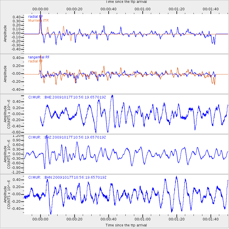
MUR Murrieta - Earthquake Result Viewer
*The percent match for this event was below the threshold and hence no stack was calculated.
| Earthquake location: |
Samoa Islands Region |
| Earthquake latitude/longitude: |
-16.4/-172.0 |
| Earthquake time(UTC): |
2009/10/17 (290) 10:45:26 GMT |
| Earthquake Depth: |
10 km |
| Earthquake Magnitude: |
5.7 MB, 5.3 MS, 5.7 MW, 5.7 MW |
| Earthquake Catalog/Contributor: |
WHDF/NEIC |
|
| Network: |
CI Caltech Regional Seismic Network |
| Station: |
MUR Murrieta |
| Lat/Lon: |
33.60 N/117.20 W |
| Elevation: |
562 m |
|
| Distance: |
72.1 deg |
| Az: |
45.784 deg |
| Baz: |
235.525 deg |
| Ray Param: |
$rayparam |
*The percent match for this event was below the threshold and hence was not used in the summary stack. |
|
| Radial Match: |
74.23809 % |
| Radial Bump: |
309 |
| Transverse Match: |
43.486244 % |
| Transverse Bump: |
378 |
| SOD ConfigId: |
2622 |
| Insert Time: |
2010-03-05 21:19:03.893 +0000 |
| GWidth: |
2.5 |
| Max Bumps: |
400 |
| Tol: |
0.001 |
|
Signal To Noise
| Channel | StoN | STA | LTA |
| CI:MUR: :BHZ:20091017T10:56:19.657019Z | 2.5607204 | 5.54468E-7 | 2.1652812E-7 |
| CI:MUR: :BHN:20091017T10:56:19.657019Z | 1.3196424 | 1.7897953E-7 | 1.356273E-7 |
| CI:MUR: :BHE:20091017T10:56:19.657019Z | 2.1531837 | 3.3432502E-7 | 1.5527007E-7 |
| Arrivals |
| Ps | |
| PpPs | |
| PsPs/PpSs | |


