You are here: Home > Network List > CI - Caltech Regional Seismic Network Stations List
> Station MUR Murrieta > Earthquake Result Viewer
MUR Murrieta - Earthquake Result Viewer
*The percent match for this event was below the threshold and hence no stack was calculated.
| Earthquake location: |
Fiji Islands Region |
| Earthquake latitude/longitude: |
-18.7/-177.7 |
| Earthquake time(UTC): |
2008/11/29 (334) 05:59:16 GMT |
| Earthquake Depth: |
386 km |
| Earthquake Magnitude: |
5.7 MB, 6.0 MW, 5.9 MW |
| Earthquake Catalog/Contributor: |
WHDF/NEIC |
|
| Network: |
CI Caltech Regional Seismic Network |
| Station: |
MUR Murrieta |
| Lat/Lon: |
33.60 N/117.20 W |
| Elevation: |
562 m |
|
| Distance: |
77.7 deg |
| Az: |
48.053 deg |
| Baz: |
237.636 deg |
| Ray Param: |
$rayparam |
*The percent match for this event was below the threshold and hence was not used in the summary stack. |
|
| Radial Match: |
72.166 % |
| Radial Bump: |
378 |
| Transverse Match: |
68.185326 % |
| Transverse Bump: |
391 |
| SOD ConfigId: |
2658 |
| Insert Time: |
2010-03-05 21:19:15.800 +0000 |
| GWidth: |
2.5 |
| Max Bumps: |
400 |
| Tol: |
0.001 |
|
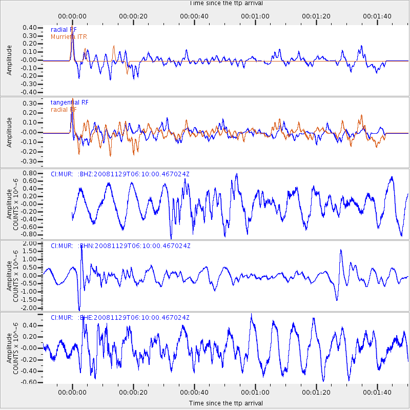
Signal To Noise
| Channel | StoN | STA | LTA |
| CI:MUR: :BHN:20081129T06:10:00.467024Z | 3.0763233 | 9.1062094E-7 | 2.9600952E-7 |
| CI:MUR: :BHE:20081129T06:10:00.467024Z | 1.1652628 | 2.3850416E-7 | 2.0467843E-7 |
| CI:MUR: :BHZ:20081129T06:10:00.467024Z | 1.2470409 | 4.1356253E-7 | 3.3163508E-7 |
| Arrivals |
| Ps | |
| PpPs | |
| PsPs/PpSs | |


