You are here: Home > Network List > CI - Caltech Regional Seismic Network Stations List
> Station MUR Murrieta > Earthquake Result Viewer
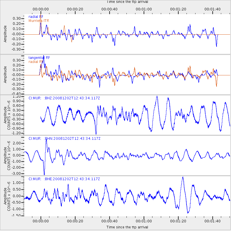
MUR Murrieta - Earthquake Result Viewer
*The percent match for this event was below the threshold and hence no stack was calculated.
| Earthquake location: |
Mariana Islands |
| Earthquake latitude/longitude: |
19.1/145.8 |
| Earthquake time(UTC): |
2008/12/02 (337) 12:31:43 GMT |
| Earthquake Depth: |
137 km |
| Earthquake Magnitude: |
5.9 MB, 5.9 MW, 5.9 MW |
| Earthquake Catalog/Contributor: |
WHDF/NEIC |
|
| Network: |
CI Caltech Regional Seismic Network |
| Station: |
MUR Murrieta |
| Lat/Lon: |
33.60 N/117.20 W |
| Elevation: |
562 m |
|
| Distance: |
85.3 deg |
| Az: |
56.215 deg |
| Baz: |
289.675 deg |
| Ray Param: |
$rayparam |
*The percent match for this event was below the threshold and hence was not used in the summary stack. |
|
| Radial Match: |
66.849686 % |
| Radial Bump: |
400 |
| Transverse Match: |
75.577034 % |
| Transverse Bump: |
400 |
| SOD ConfigId: |
2658 |
| Insert Time: |
2010-03-05 21:19:16.696 +0000 |
| GWidth: |
2.5 |
| Max Bumps: |
400 |
| Tol: |
0.001 |
|
Signal To Noise
| Channel | StoN | STA | LTA |
| CI:MUR: :BHN:20081202T12:43:34.117Z | 2.728773 | 1.4761076E-6 | 5.409418E-7 |
| CI:MUR: :BHE:20081202T12:43:34.117Z | 2.1754594 | 2.752107E-7 | 1.2650693E-7 |
| CI:MUR: :BHZ:20081202T12:43:34.117Z | 1.4418317 | 5.0878623E-7 | 3.528749E-7 |
| Arrivals |
| Ps | |
| PpPs | |
| PsPs/PpSs | |


