You are here: Home > Network List > CI - Caltech Regional Seismic Network Stations List
> Station MUR Murrieta > Earthquake Result Viewer
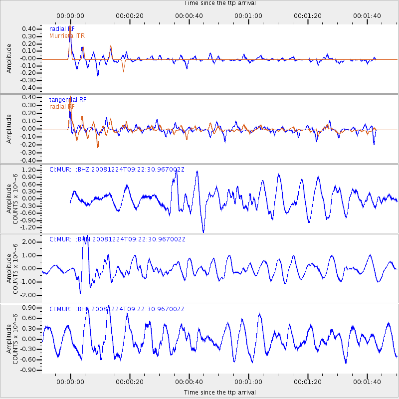
MUR Murrieta - Earthquake Result Viewer
*The percent match for this event was below the threshold and hence no stack was calculated.
| Earthquake location: |
Tonga Islands Region |
| Earthquake latitude/longitude: |
-17.3/-171.9 |
| Earthquake time(UTC): |
2008/12/24 (359) 09:11:34 GMT |
| Earthquake Depth: |
9.0 km |
| Earthquake Magnitude: |
5.9 MB, 5.6 MS, 6.0 MW, 6.0 MW |
| Earthquake Catalog/Contributor: |
WHDF/NEIC |
|
| Network: |
CI Caltech Regional Seismic Network |
| Station: |
MUR Murrieta |
| Lat/Lon: |
33.60 N/117.20 W |
| Elevation: |
562 m |
|
| Distance: |
72.7 deg |
| Az: |
45.536 deg |
| Baz: |
234.78 deg |
| Ray Param: |
$rayparam |
*The percent match for this event was below the threshold and hence was not used in the summary stack. |
|
| Radial Match: |
54.756737 % |
| Radial Bump: |
273 |
| Transverse Match: |
56.392807 % |
| Transverse Bump: |
400 |
| SOD ConfigId: |
2658 |
| Insert Time: |
2010-03-05 21:19:27.677 +0000 |
| GWidth: |
2.5 |
| Max Bumps: |
400 |
| Tol: |
0.001 |
|
Signal To Noise
| Channel | StoN | STA | LTA |
| CI:MUR: :BHN:20081224T09:22:30.967002Z | 5.9363575 | 1.0166724E-6 | 1.7126199E-7 |
| CI:MUR: :BHE:20081224T09:22:30.967002Z | 1.5512483 | 3.3009988E-7 | 2.1279628E-7 |
| CI:MUR: :BHZ:20081224T09:22:30.967002Z | 1.7091205 | 3.950073E-7 | 2.311173E-7 |
| Arrivals |
| Ps | |
| PpPs | |
| PsPs/PpSs | |


