You are here: Home > Network List > CI - Caltech Regional Seismic Network Stations List
> Station MUR Murrieta > Earthquake Result Viewer
MUR Murrieta - Earthquake Result Viewer
*The percent match for this event was below the threshold and hence no stack was calculated.
| Earthquake location: |
Samoa Islands Region |
| Earthquake latitude/longitude: |
-17.0/-172.1 |
| Earthquake time(UTC): |
2009/01/28 (028) 12:39:42 GMT |
| Earthquake Depth: |
10 km |
| Earthquake Magnitude: |
5.6 MB, 5.3 MS, 5.5 MW |
| Earthquake Catalog/Contributor: |
WHDF/NEIC |
|
| Network: |
CI Caltech Regional Seismic Network |
| Station: |
MUR Murrieta |
| Lat/Lon: |
33.60 N/117.20 W |
| Elevation: |
562 m |
|
| Distance: |
72.6 deg |
| Az: |
45.687 deg |
| Baz: |
235.128 deg |
| Ray Param: |
$rayparam |
*The percent match for this event was below the threshold and hence was not used in the summary stack. |
|
| Radial Match: |
67.1438 % |
| Radial Bump: |
381 |
| Transverse Match: |
63.91952 % |
| Transverse Bump: |
400 |
| SOD ConfigId: |
2658 |
| Insert Time: |
2010-03-05 21:19:37.797 +0000 |
| GWidth: |
2.5 |
| Max Bumps: |
400 |
| Tol: |
0.001 |
|
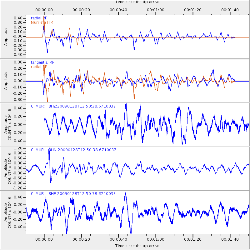
Signal To Noise
| Channel | StoN | STA | LTA |
| CI:MUR: :BHN:20090128T12:50:38.671003Z | 4.3584976 | 5.294211E-7 | 1.214687E-7 |
| CI:MUR: :BHE:20090128T12:50:38.671003Z | 2.1144364 | 2.1602511E-7 | 1.0216676E-7 |
| CI:MUR: :BHZ:20090128T12:50:38.671003Z | 1.3350177 | 1.8482196E-7 | 1.3844158E-7 |
| Arrivals |
| Ps | |
| PpPs | |
| PsPs/PpSs | |


