You are here: Home > Network List > TA - USArray Transportable Network (new EarthScope stations) Stations List
> Station R11A Troy Canyon, Currant, NV, USA > Earthquake Result Viewer
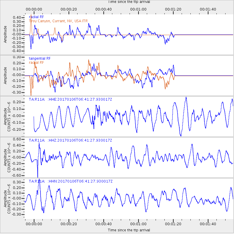
R11A Troy Canyon, Currant, NV, USA - Earthquake Result Viewer
*The percent match for this event was below the threshold and hence no stack was calculated.
| Earthquake location: |
Chile-Bolivia Border Region |
| Earthquake latitude/longitude: |
-22.4/-67.7 |
| Earthquake time(UTC): |
2017/01/06 (006) 06:30:33 GMT |
| Earthquake Depth: |
142 km |
| Earthquake Magnitude: |
5.7 mb |
| Earthquake Catalog/Contributor: |
NEIC PDE/us |
|
| Network: |
TA USArray Transportable Network (new EarthScope stations) |
| Station: |
R11A Troy Canyon, Currant, NV, USA |
| Lat/Lon: |
38.35 N/115.59 W |
| Elevation: |
1756 m |
|
| Distance: |
75.3 deg |
| Az: |
322.896 deg |
| Baz: |
134.745 deg |
| Ray Param: |
$rayparam |
*The percent match for this event was below the threshold and hence was not used in the summary stack. |
|
| Radial Match: |
57.98257 % |
| Radial Bump: |
400 |
| Transverse Match: |
37.506207 % |
| Transverse Bump: |
400 |
| SOD ConfigId: |
11737051 |
| Insert Time: |
2019-04-26 13:42:23.831 +0000 |
| GWidth: |
2.5 |
| Max Bumps: |
400 |
| Tol: |
0.001 |
|
Signal To Noise
| Channel | StoN | STA | LTA |
| TA:R11A: :HHZ:20170106T06:41:27.930017Z | 1.707315 | 2.1850393E-7 | 1.2798104E-7 |
| TA:R11A: :HHN:20170106T06:41:27.930017Z | 2.0739315 | 1.9304566E-7 | 9.308199E-8 |
| TA:R11A: :HHE:20170106T06:41:27.930017Z | 0.9877745 | 1.0762912E-7 | 1.08961224E-7 |
| Arrivals |
| Ps | |
| PpPs | |
| PsPs/PpSs | |


