You are here: Home > Network List > GS - US Geological Survey Networks Stations List
> Station KAN13 Rinehart Farm > Earthquake Result Viewer
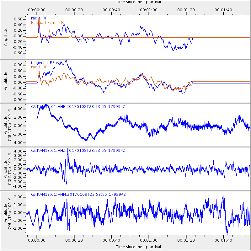
KAN13 Rinehart Farm - Earthquake Result Viewer
*The percent match for this event was below the threshold and hence no stack was calculated.
| Earthquake location: |
Queen Elizabeth Islands, Canada |
| Earthquake latitude/longitude: |
74.3/-92.3 |
| Earthquake time(UTC): |
2017/01/08 (008) 23:47:12 GMT |
| Earthquake Depth: |
19 km |
| Earthquake Magnitude: |
5.8 Mwp |
| Earthquake Catalog/Contributor: |
NEIC PDE/us |
|
| Network: |
GS US Geological Survey Networks |
| Station: |
KAN13 Rinehart Farm |
| Lat/Lon: |
37.01 N/97.48 W |
| Elevation: |
340 m |
|
| Distance: |
37.5 deg |
| Az: |
186.812 deg |
| Baz: |
2.309 deg |
| Ray Param: |
$rayparam |
*The percent match for this event was below the threshold and hence was not used in the summary stack. |
|
| Radial Match: |
45.964806 % |
| Radial Bump: |
400 |
| Transverse Match: |
25.93352 % |
| Transverse Bump: |
400 |
| SOD ConfigId: |
11737051 |
| Insert Time: |
2019-04-26 14:08:38.780 +0000 |
| GWidth: |
2.5 |
| Max Bumps: |
400 |
| Tol: |
0.001 |
|
Signal To Noise
| Channel | StoN | STA | LTA |
| GS:KAN13:01:HHZ:20170108T23:53:55.179994Z | 2.0781338 | 5.896096E-7 | 2.837207E-7 |
| GS:KAN13:01:HHN:20170108T23:53:55.179994Z | 2.5875752 | 1.3569461E-6 | 5.244084E-7 |
| GS:KAN13:01:HHE:20170108T23:53:55.179994Z | 1.7454718 | 3.6735153E-6 | 2.1045973E-6 |
| Arrivals |
| Ps | |
| PpPs | |
| PsPs/PpSs | |


