You are here: Home > Network List > TA - USArray Transportable Network (new EarthScope stations) Stations List
> Station L44A Lake County Forest Preserve, Grayslake, IL, USA > Earthquake Result Viewer
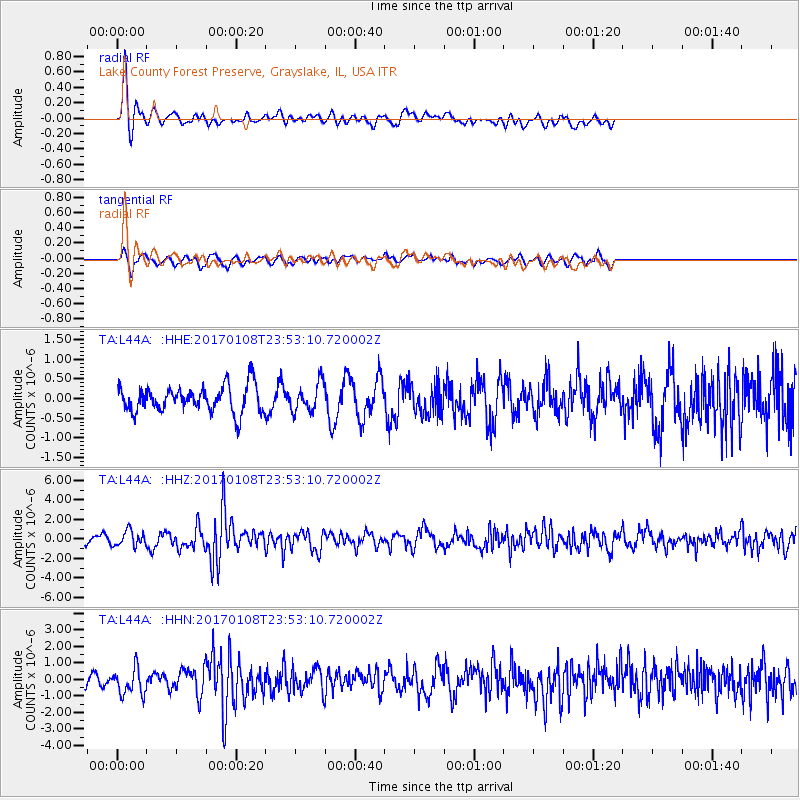
L44A Lake County Forest Preserve, Grayslake, IL, USA - Earthquake Result Viewer
*The percent match for this event was below the threshold and hence no stack was calculated.
| Earthquake location: |
Queen Elizabeth Islands, Canada |
| Earthquake latitude/longitude: |
74.3/-92.3 |
| Earthquake time(UTC): |
2017/01/08 (008) 23:47:12 GMT |
| Earthquake Depth: |
19 km |
| Earthquake Magnitude: |
5.8 Mwp |
| Earthquake Catalog/Contributor: |
NEIC PDE/us |
|
| Network: |
TA USArray Transportable Network (new EarthScope stations) |
| Station: |
L44A Lake County Forest Preserve, Grayslake, IL, USA |
| Lat/Lon: |
42.18 N/87.91 W |
| Elevation: |
202 m |
|
| Distance: |
32.3 deg |
| Az: |
173.883 deg |
| Baz: |
357.766 deg |
| Ray Param: |
$rayparam |
*The percent match for this event was below the threshold and hence was not used in the summary stack. |
|
| Radial Match: |
72.165215 % |
| Radial Bump: |
400 |
| Transverse Match: |
57.644283 % |
| Transverse Bump: |
400 |
| SOD ConfigId: |
11737051 |
| Insert Time: |
2019-04-26 14:13:33.647 +0000 |
| GWidth: |
2.5 |
| Max Bumps: |
400 |
| Tol: |
0.001 |
|
Signal To Noise
| Channel | StoN | STA | LTA |
| TA:L44A: :HHZ:20170108T23:53:10.720002Z | 2.525588 | 7.962478E-7 | 3.1527225E-7 |
| TA:L44A: :HHN:20170108T23:53:10.720002Z | 2.2405038 | 7.9578996E-7 | 3.551835E-7 |
| TA:L44A: :HHE:20170108T23:53:10.720002Z | 0.7931448 | 2.6293807E-7 | 3.3151332E-7 |
| Arrivals |
| Ps | |
| PpPs | |
| PsPs/PpSs | |


