You are here: Home > Network List > TA - USArray Transportable Network (new EarthScope stations) Stations List
> Station N23A Red Feather Lakes, CO, USA > Earthquake Result Viewer
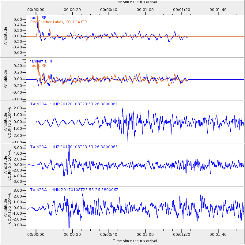
N23A Red Feather Lakes, CO, USA - Earthquake Result Viewer
*The percent match for this event was below the threshold and hence no stack was calculated.
| Earthquake location: |
Queen Elizabeth Islands, Canada |
| Earthquake latitude/longitude: |
74.3/-92.3 |
| Earthquake time(UTC): |
2017/01/08 (008) 23:47:12 GMT |
| Earthquake Depth: |
19 km |
| Earthquake Magnitude: |
5.8 Mwp |
| Earthquake Catalog/Contributor: |
NEIC PDE/us |
|
| Network: |
TA USArray Transportable Network (new EarthScope stations) |
| Station: |
N23A Red Feather Lakes, CO, USA |
| Lat/Lon: |
40.89 N/105.94 W |
| Elevation: |
2458 m |
|
| Distance: |
34.1 deg |
| Az: |
198.586 deg |
| Baz: |
6.565 deg |
| Ray Param: |
$rayparam |
*The percent match for this event was below the threshold and hence was not used in the summary stack. |
|
| Radial Match: |
74.81301 % |
| Radial Bump: |
384 |
| Transverse Match: |
69.047 % |
| Transverse Bump: |
400 |
| SOD ConfigId: |
11737051 |
| Insert Time: |
2019-04-26 14:13:34.062 +0000 |
| GWidth: |
2.5 |
| Max Bumps: |
400 |
| Tol: |
0.001 |
|
Signal To Noise
| Channel | StoN | STA | LTA |
| TA:N23A: :HHZ:20170108T23:53:26.380006Z | 2.3082824 | 6.522266E-7 | 2.8255928E-7 |
| TA:N23A: :HHN:20170108T23:53:26.380006Z | 0.83703494 | 2.3320364E-7 | 2.7860682E-7 |
| TA:N23A: :HHE:20170108T23:53:26.380006Z | 1.2130592 | 3.498841E-7 | 2.884312E-7 |
| Arrivals |
| Ps | |
| PpPs | |
| PsPs/PpSs | |


