You are here: Home > Network List > PF - Volcanologic Network of Piton de Fournaise-OVPF Stations List
> Station BON Bory Nord > Earthquake Result Viewer
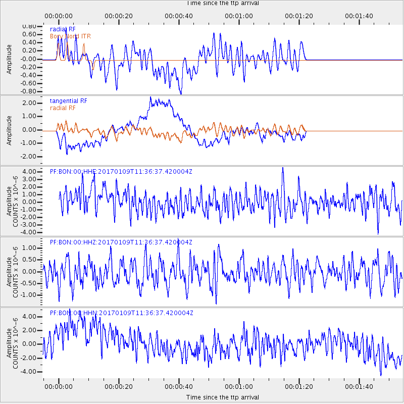
BON Bory Nord - Earthquake Result Viewer
*The percent match for this event was below the threshold and hence no stack was calculated.
| Earthquake location: |
Southern Sumatra, Indonesia |
| Earthquake latitude/longitude: |
-1.6/100.3 |
| Earthquake time(UTC): |
2017/01/09 (009) 11:28:38 GMT |
| Earthquake Depth: |
64 km |
| Earthquake Magnitude: |
5.5 mb |
| Earthquake Catalog/Contributor: |
NEIC PDE/us |
|
| Network: |
PF Volcanologic Network of Piton de Fournaise-OVPF |
| Station: |
BON Bory Nord |
| Lat/Lon: |
21.24 S/55.71 E |
| Elevation: |
2552 m |
|
| Distance: |
47.6 deg |
| Az: |
242.51 deg |
| Baz: |
71.901 deg |
| Ray Param: |
$rayparam |
*The percent match for this event was below the threshold and hence was not used in the summary stack. |
|
| Radial Match: |
47.632034 % |
| Radial Bump: |
400 |
| Transverse Match: |
61.027782 % |
| Transverse Bump: |
400 |
| SOD ConfigId: |
11737051 |
| Insert Time: |
2019-04-26 14:18:48.437 +0000 |
| GWidth: |
2.5 |
| Max Bumps: |
400 |
| Tol: |
0.001 |
|
Signal To Noise
| Channel | StoN | STA | LTA |
| PF:BON:00:HHZ:20170109T11:36:37.420004Z | 1.3056136 | 6.110267E-7 | 4.679996E-7 |
| PF:BON:00:HHN:20170109T11:36:37.420004Z | 3.7710354 | 6.1171563E-6 | 1.6221423E-6 |
| PF:BON:00:HHE:20170109T11:36:37.420004Z | 1.3324666 | 1.7719503E-6 | 1.3298272E-6 |
| Arrivals |
| Ps | |
| PpPs | |
| PsPs/PpSs | |


