You are here: Home > Network List > TA - USArray Transportable Network (new EarthScope stations) Stations List
> Station F21K Alatna River, AK, USA > Earthquake Result Viewer
F21K Alatna River, AK, USA - Earthquake Result Viewer
*The percent match for this event was below the threshold and hence no stack was calculated.
| Earthquake location: |
Celebes Sea |
| Earthquake latitude/longitude: |
4.4/122.7 |
| Earthquake time(UTC): |
2017/01/10 (010) 06:13:48 GMT |
| Earthquake Depth: |
622 km |
| Earthquake Magnitude: |
6.9 Mi |
| Earthquake Catalog/Contributor: |
NEIC PDE/at |
|
| Network: |
TA USArray Transportable Network (new EarthScope stations) |
| Station: |
F21K Alatna River, AK, USA |
| Lat/Lon: |
67.22 N/153.48 W |
| Elevation: |
597 m |
|
| Distance: |
83.5 deg |
| Az: |
22.928 deg |
| Baz: |
266.003 deg |
| Ray Param: |
$rayparam |
*The percent match for this event was below the threshold and hence was not used in the summary stack. |
|
| Radial Match: |
77.8142 % |
| Radial Bump: |
400 |
| Transverse Match: |
80.02057 % |
| Transverse Bump: |
400 |
| SOD ConfigId: |
11737051 |
| Insert Time: |
2019-04-26 14:25:33.998 +0000 |
| GWidth: |
2.5 |
| Max Bumps: |
400 |
| Tol: |
0.001 |
|
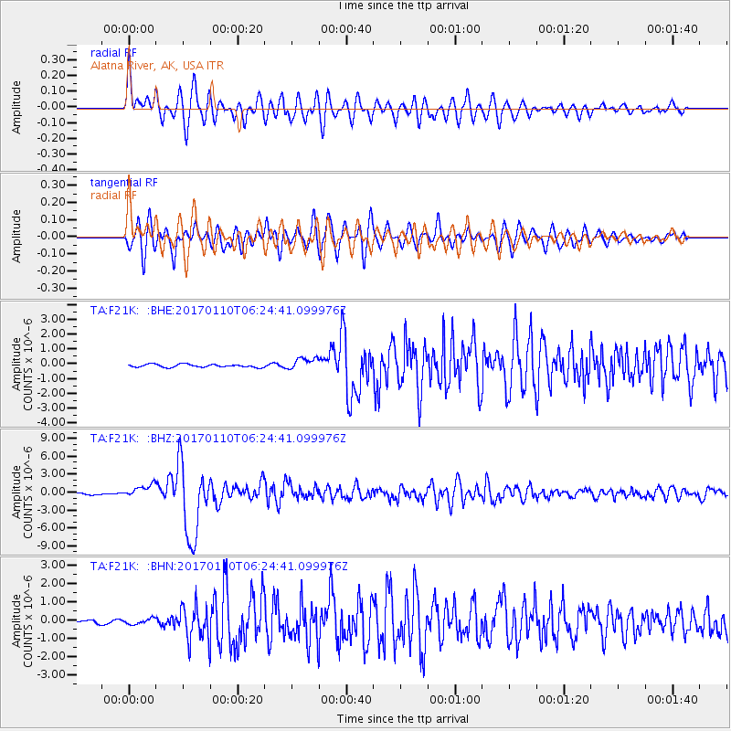
Signal To Noise
| Channel | StoN | STA | LTA |
| TA:F21K: :BHZ:20170110T06:24:41.099976Z | 6.4813786 | 1.1141873E-6 | 1.7190591E-7 |
| TA:F21K: :BHN:20170110T06:24:41.099976Z | 1.958633 | 1.5375649E-7 | 7.850194E-8 |
| TA:F21K: :BHE:20170110T06:24:41.099976Z | 4.1951394 | 4.111912E-7 | 9.80161E-8 |
| Arrivals |
| Ps | |
| PpPs | |
| PsPs/PpSs | |


