You are here: Home > Network List > TA - USArray Transportable Network (new EarthScope stations) Stations List
> Station J25K Salcha River, AK, USA > Earthquake Result Viewer
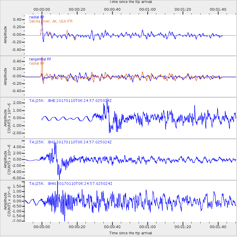
J25K Salcha River, AK, USA - Earthquake Result Viewer
*The percent match for this event was below the threshold and hence no stack was calculated.
| Earthquake location: |
Celebes Sea |
| Earthquake latitude/longitude: |
4.4/122.7 |
| Earthquake time(UTC): |
2017/01/10 (010) 06:13:48 GMT |
| Earthquake Depth: |
622 km |
| Earthquake Magnitude: |
6.9 Mi |
| Earthquake Catalog/Contributor: |
NEIC PDE/at |
|
| Network: |
TA USArray Transportable Network (new EarthScope stations) |
| Station: |
J25K Salcha River, AK, USA |
| Lat/Lon: |
64.61 N/145.37 W |
| Elevation: |
949 m |
|
| Distance: |
86.9 deg |
| Az: |
25.562 deg |
| Baz: |
273.626 deg |
| Ray Param: |
$rayparam |
*The percent match for this event was below the threshold and hence was not used in the summary stack. |
|
| Radial Match: |
75.24541 % |
| Radial Bump: |
400 |
| Transverse Match: |
63.739002 % |
| Transverse Bump: |
400 |
| SOD ConfigId: |
11737051 |
| Insert Time: |
2019-04-26 14:25:51.862 +0000 |
| GWidth: |
2.5 |
| Max Bumps: |
400 |
| Tol: |
0.001 |
|
Signal To Noise
| Channel | StoN | STA | LTA |
| TA:J25K: :BHZ:20170110T06:24:57.025024Z | 5.1826644 | 1.0313357E-6 | 1.9899721E-7 |
| TA:J25K: :BHN:20170110T06:24:57.025024Z | 0.9160754 | 2.3860852E-7 | 2.6046823E-7 |
| TA:J25K: :BHE:20170110T06:24:57.025024Z | 2.3819103 | 3.8582453E-7 | 1.6198115E-7 |
| Arrivals |
| Ps | |
| PpPs | |
| PsPs/PpSs | |


