You are here: Home > Network List > TA - USArray Transportable Network (new EarthScope stations) Stations List
> Station L20K Farewell, AK, USA > Earthquake Result Viewer
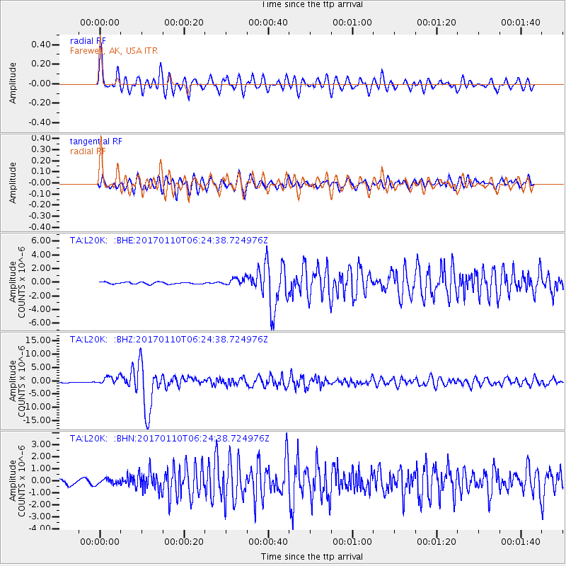
L20K Farewell, AK, USA - Earthquake Result Viewer
*The percent match for this event was below the threshold and hence no stack was calculated.
| Earthquake location: |
Celebes Sea |
| Earthquake latitude/longitude: |
4.4/122.7 |
| Earthquake time(UTC): |
2017/01/10 (010) 06:13:48 GMT |
| Earthquake Depth: |
622 km |
| Earthquake Magnitude: |
6.9 Mi |
| Earthquake Catalog/Contributor: |
NEIC PDE/at |
|
| Network: |
TA USArray Transportable Network (new EarthScope stations) |
| Station: |
L20K Farewell, AK, USA |
| Lat/Lon: |
62.48 N/153.88 W |
| Elevation: |
673 m |
|
| Distance: |
83.1 deg |
| Az: |
27.702 deg |
| Baz: |
266.202 deg |
| Ray Param: |
$rayparam |
*The percent match for this event was below the threshold and hence was not used in the summary stack. |
|
| Radial Match: |
78.937645 % |
| Radial Bump: |
400 |
| Transverse Match: |
82.327896 % |
| Transverse Bump: |
400 |
| SOD ConfigId: |
11737051 |
| Insert Time: |
2019-04-26 14:25:57.715 +0000 |
| GWidth: |
2.5 |
| Max Bumps: |
400 |
| Tol: |
0.001 |
|
Signal To Noise
| Channel | StoN | STA | LTA |
| TA:L20K: :BHZ:20170110T06:24:38.724976Z | 4.489502 | 1.6168088E-6 | 3.6013103E-7 |
| TA:L20K: :BHN:20170110T06:24:38.724976Z | 0.5852762 | 2.0453412E-7 | 3.4946598E-7 |
| TA:L20K: :BHE:20170110T06:24:38.724976Z | 3.7787707 | 5.3073114E-7 | 1.4045075E-7 |
| Arrivals |
| Ps | |
| PpPs | |
| PsPs/PpSs | |


