You are here: Home > Network List > TA - USArray Transportable Network (new EarthScope stations) Stations List
> Station M31M Drury Creek, Yukon, CA > Earthquake Result Viewer
M31M Drury Creek, Yukon, CA - Earthquake Result Viewer
*The percent match for this event was below the threshold and hence no stack was calculated.
| Earthquake location: |
Celebes Sea |
| Earthquake latitude/longitude: |
4.4/122.7 |
| Earthquake time(UTC): |
2017/01/10 (010) 06:13:48 GMT |
| Earthquake Depth: |
622 km |
| Earthquake Magnitude: |
6.9 Mi |
| Earthquake Catalog/Contributor: |
NEIC PDE/at |
|
| Network: |
TA USArray Transportable Network (new EarthScope stations) |
| Station: |
M31M Drury Creek, Yukon, CA |
| Lat/Lon: |
62.20 N/134.39 W |
| Elevation: |
639 m |
|
| Distance: |
92.1 deg |
| Az: |
27.212 deg |
| Baz: |
283.454 deg |
| Ray Param: |
$rayparam |
*The percent match for this event was below the threshold and hence was not used in the summary stack. |
|
| Radial Match: |
73.45574 % |
| Radial Bump: |
400 |
| Transverse Match: |
75.81249 % |
| Transverse Bump: |
400 |
| SOD ConfigId: |
11737051 |
| Insert Time: |
2019-04-26 14:26:07.548 +0000 |
| GWidth: |
2.5 |
| Max Bumps: |
400 |
| Tol: |
0.001 |
|
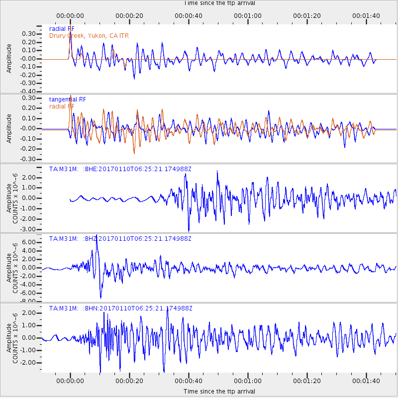
Signal To Noise
| Channel | StoN | STA | LTA |
| TA:M31M: :BHZ:20170110T06:25:21.174988Z | 4.151454 | 6.6541463E-7 | 1.6028473E-7 |
| TA:M31M: :BHN:20170110T06:25:21.174988Z | 1.0153053 | 1.6886857E-7 | 1.6632295E-7 |
| TA:M31M: :BHE:20170110T06:25:21.174988Z | 2.8410003 | 3.9803822E-7 | 1.4010496E-7 |
| Arrivals |
| Ps | |
| PpPs | |
| PsPs/PpSs | |


