You are here: Home > Network List > AV - Alaska Volcano Observatory Stations List
> Station AMKA Regional Station, Amchitka Island, Alaska > Earthquake Result Viewer
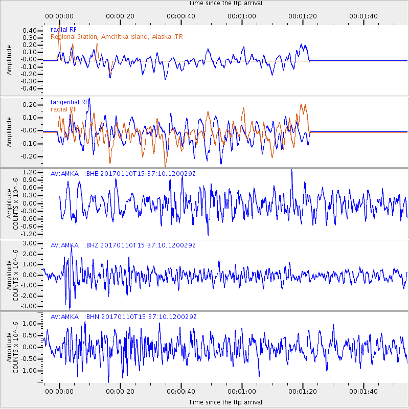
AMKA Regional Station, Amchitka Island, Alaska - Earthquake Result Viewer
*The percent match for this event was below the threshold and hence no stack was calculated.
| Earthquake location: |
Solomon Islands |
| Earthquake latitude/longitude: |
-10.1/161.0 |
| Earthquake time(UTC): |
2017/01/10 (010) 15:27:15 GMT |
| Earthquake Depth: |
28 km |
| Earthquake Magnitude: |
6.3 Mww |
| Earthquake Catalog/Contributor: |
NEIC PDE/us |
|
| Network: |
AV Alaska Volcano Observatory |
| Station: |
AMKA Regional Station, Amchitka Island, Alaska |
| Lat/Lon: |
51.38 N/179.30 E |
| Elevation: |
116 m |
|
| Distance: |
63.3 deg |
| Az: |
12.711 deg |
| Baz: |
200.223 deg |
| Ray Param: |
$rayparam |
*The percent match for this event was below the threshold and hence was not used in the summary stack. |
|
| Radial Match: |
55.53999 % |
| Radial Bump: |
400 |
| Transverse Match: |
45.86521 % |
| Transverse Bump: |
359 |
| SOD ConfigId: |
11737051 |
| Insert Time: |
2019-04-26 14:29:55.304 +0000 |
| GWidth: |
2.5 |
| Max Bumps: |
400 |
| Tol: |
0.001 |
|
Signal To Noise
| Channel | StoN | STA | LTA |
| AV:AMKA: :BHZ:20170110T15:37:10.120029Z | 3.6346273 | 1.3087132E-6 | 3.6006804E-7 |
| AV:AMKA: :BHN:20170110T15:37:10.120029Z | 1.1007136 | 4.2089E-7 | 3.823792E-7 |
| AV:AMKA: :BHE:20170110T15:37:10.120029Z | 0.65196884 | 2.6545194E-7 | 4.0715435E-7 |
| Arrivals |
| Ps | |
| PpPs | |
| PsPs/PpSs | |


