You are here: Home > Network List > AV - Alaska Volcano Observatory Stations List
> Station MNAT Nateekin Bay, Makushin Volcano, Alaska > Earthquake Result Viewer
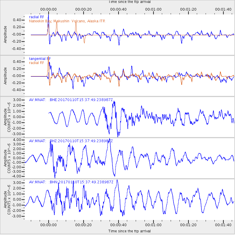
MNAT Nateekin Bay, Makushin Volcano, Alaska - Earthquake Result Viewer
*The percent match for this event was below the threshold and hence no stack was calculated.
| Earthquake location: |
Solomon Islands |
| Earthquake latitude/longitude: |
-10.1/161.0 |
| Earthquake time(UTC): |
2017/01/10 (010) 15:27:15 GMT |
| Earthquake Depth: |
28 km |
| Earthquake Magnitude: |
6.3 Mww |
| Earthquake Catalog/Contributor: |
NEIC PDE/us |
|
| Network: |
AV Alaska Volcano Observatory |
| Station: |
MNAT Nateekin Bay, Makushin Volcano, Alaska |
| Lat/Lon: |
53.88 N/166.69 W |
| Elevation: |
390 m |
|
| Distance: |
69.4 deg |
| Az: |
19.746 deg |
| Baz: |
214.186 deg |
| Ray Param: |
$rayparam |
*The percent match for this event was below the threshold and hence was not used in the summary stack. |
|
| Radial Match: |
61.914543 % |
| Radial Bump: |
400 |
| Transverse Match: |
67.731804 % |
| Transverse Bump: |
400 |
| SOD ConfigId: |
11737051 |
| Insert Time: |
2019-04-26 14:30:06.062 +0000 |
| GWidth: |
2.5 |
| Max Bumps: |
400 |
| Tol: |
0.001 |
|
Signal To Noise
| Channel | StoN | STA | LTA |
| AV:MNAT: :BHZ:20170110T15:37:49.238987Z | 4.4908094 | 2.3010516E-6 | 5.1239124E-7 |
| AV:MNAT: :BHN:20170110T15:37:49.238987Z | 1.6410602 | 1.2827544E-6 | 7.8166204E-7 |
| AV:MNAT: :BHE:20170110T15:37:49.238987Z | 1.7116377 | 1.4515039E-6 | 8.480205E-7 |
| Arrivals |
| Ps | |
| PpPs | |
| PsPs/PpSs | |


