You are here: Home > Network List > CI - Caltech Regional Seismic Network Stations List
> Station BAR Barrett, Tecate, CA, USA > Earthquake Result Viewer
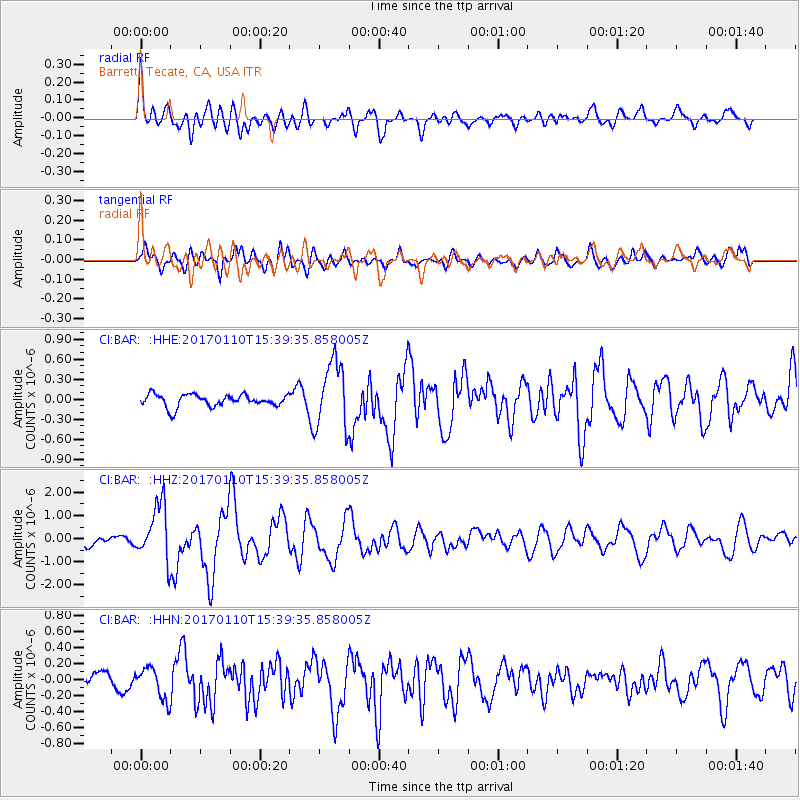
BAR Barrett, Tecate, CA, USA - Earthquake Result Viewer
*The percent match for this event was below the threshold and hence no stack was calculated.
| Earthquake location: |
Solomon Islands |
| Earthquake latitude/longitude: |
-10.1/161.0 |
| Earthquake time(UTC): |
2017/01/10 (010) 15:27:15 GMT |
| Earthquake Depth: |
28 km |
| Earthquake Magnitude: |
6.3 Mww |
| Earthquake Catalog/Contributor: |
NEIC PDE/us |
|
| Network: |
CI Caltech Regional Seismic Network |
| Station: |
BAR Barrett, Tecate, CA, USA |
| Lat/Lon: |
32.68 N/116.67 W |
| Elevation: |
521 m |
|
| Distance: |
89.0 deg |
| Az: |
56.706 deg |
| Baz: |
257.389 deg |
| Ray Param: |
$rayparam |
*The percent match for this event was below the threshold and hence was not used in the summary stack. |
|
| Radial Match: |
74.87744 % |
| Radial Bump: |
400 |
| Transverse Match: |
71.7627 % |
| Transverse Bump: |
400 |
| SOD ConfigId: |
11737051 |
| Insert Time: |
2019-04-26 14:30:53.373 +0000 |
| GWidth: |
2.5 |
| Max Bumps: |
400 |
| Tol: |
0.001 |
|
Signal To Noise
| Channel | StoN | STA | LTA |
| CI:BAR: :HHZ:20170110T15:39:35.858005Z | 5.5914025 | 1.2093773E-6 | 2.1629229E-7 |
| CI:BAR: :HHN:20170110T15:39:35.858005Z | 1.7725776 | 1.943548E-7 | 1.0964529E-7 |
| CI:BAR: :HHE:20170110T15:39:35.858005Z | 5.49599 | 5.0115614E-7 | 9.118578E-8 |
| Arrivals |
| Ps | |
| PpPs | |
| PsPs/PpSs | |


