You are here: Home > Network List > TA - USArray Transportable Network (new EarthScope stations) Stations List
> Station A36M Sachs Harbour, NT, CAN > Earthquake Result Viewer
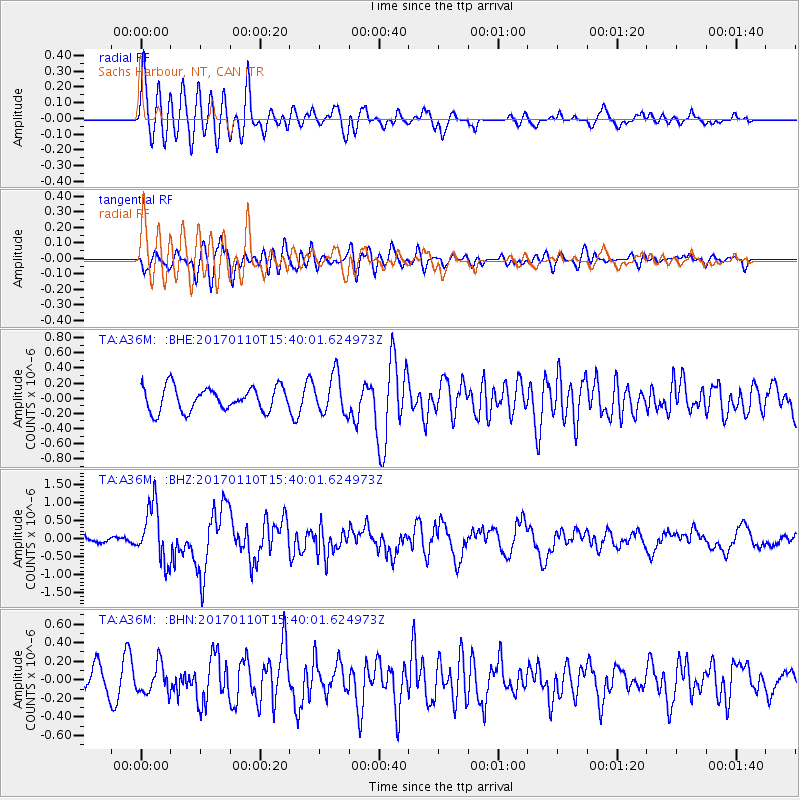
A36M Sachs Harbour, NT, CAN - Earthquake Result Viewer
*The percent match for this event was below the threshold and hence no stack was calculated.
| Earthquake location: |
Solomon Islands |
| Earthquake latitude/longitude: |
-10.1/161.0 |
| Earthquake time(UTC): |
2017/01/10 (010) 15:27:15 GMT |
| Earthquake Depth: |
28 km |
| Earthquake Magnitude: |
6.3 Mww |
| Earthquake Catalog/Contributor: |
NEIC PDE/us |
|
| Network: |
TA USArray Transportable Network (new EarthScope stations) |
| Station: |
A36M Sachs Harbour, NT, CAN |
| Lat/Lon: |
71.99 N/125.25 W |
| Elevation: |
32 m |
|
| Distance: |
94.6 deg |
| Az: |
17.434 deg |
| Baz: |
251.48 deg |
| Ray Param: |
$rayparam |
*The percent match for this event was below the threshold and hence was not used in the summary stack. |
|
| Radial Match: |
67.3385 % |
| Radial Bump: |
400 |
| Transverse Match: |
58.665733 % |
| Transverse Bump: |
400 |
| SOD ConfigId: |
11737051 |
| Insert Time: |
2019-04-26 14:34:02.003 +0000 |
| GWidth: |
2.5 |
| Max Bumps: |
400 |
| Tol: |
0.001 |
|
Signal To Noise
| Channel | StoN | STA | LTA |
| TA:A36M: :BHZ:20170110T15:40:01.624973Z | 4.9790373 | 7.7590477E-7 | 1.558343E-7 |
| TA:A36M: :BHN:20170110T15:40:01.624973Z | 1.5121299 | 1.5669889E-7 | 1.03627926E-7 |
| TA:A36M: :BHE:20170110T15:40:01.624973Z | 1.6602697 | 2.5724898E-7 | 1.5494409E-7 |
| Arrivals |
| Ps | |
| PpPs | |
| PsPs/PpSs | |


