You are here: Home > Network List > TA - USArray Transportable Network (new EarthScope stations) Stations List
> Station F21K Alatna River, AK, USA > Earthquake Result Viewer
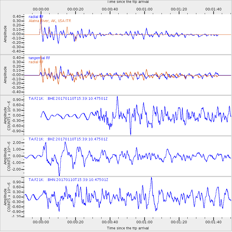
F21K Alatna River, AK, USA - Earthquake Result Viewer
*The percent match for this event was below the threshold and hence no stack was calculated.
| Earthquake location: |
Solomon Islands |
| Earthquake latitude/longitude: |
-10.1/161.0 |
| Earthquake time(UTC): |
2017/01/10 (010) 15:27:15 GMT |
| Earthquake Depth: |
28 km |
| Earthquake Magnitude: |
6.3 Mww |
| Earthquake Catalog/Contributor: |
NEIC PDE/us |
|
| Network: |
TA USArray Transportable Network (new EarthScope stations) |
| Station: |
F21K Alatna River, AK, USA |
| Lat/Lon: |
67.22 N/153.48 W |
| Elevation: |
597 m |
|
| Distance: |
83.8 deg |
| Az: |
16.218 deg |
| Baz: |
224.931 deg |
| Ray Param: |
$rayparam |
*The percent match for this event was below the threshold and hence was not used in the summary stack. |
|
| Radial Match: |
76.73356 % |
| Radial Bump: |
400 |
| Transverse Match: |
73.49778 % |
| Transverse Bump: |
400 |
| SOD ConfigId: |
11737051 |
| Insert Time: |
2019-04-26 14:34:11.767 +0000 |
| GWidth: |
2.5 |
| Max Bumps: |
400 |
| Tol: |
0.001 |
|
Signal To Noise
| Channel | StoN | STA | LTA |
| TA:F21K: :BHZ:20170110T15:39:10.47501Z | 4.999194 | 9.772674E-7 | 1.9548499E-7 |
| TA:F21K: :BHN:20170110T15:39:10.47501Z | 3.191756 | 2.7218437E-7 | 8.527731E-8 |
| TA:F21K: :BHE:20170110T15:39:10.47501Z | 1.8013949 | 1.8892263E-7 | 1.0487574E-7 |
| Arrivals |
| Ps | |
| PpPs | |
| PsPs/PpSs | |


