You are here: Home > Network List > CN - Canadian National Seismograph Network Stations List
> Station INK INUVIK, NT > Earthquake Result Viewer
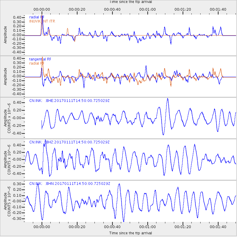
INK INUVIK, NT - Earthquake Result Viewer
*The percent match for this event was below the threshold and hence no stack was calculated.
| Earthquake location: |
South Of Mariana Islands |
| Earthquake latitude/longitude: |
12.2/141.1 |
| Earthquake time(UTC): |
2017/01/11 (011) 14:38:39 GMT |
| Earthquake Depth: |
10 km |
| Earthquake Magnitude: |
5.5 mb |
| Earthquake Catalog/Contributor: |
NEIC PDE/us |
|
| Network: |
CN Canadian National Seismograph Network |
| Station: |
INK INUVIK, NT |
| Lat/Lon: |
68.31 N/133.53 W |
| Elevation: |
44 m |
|
| Distance: |
77.0 deg |
| Az: |
22.353 deg |
| Baz: |
270.322 deg |
| Ray Param: |
$rayparam |
*The percent match for this event was below the threshold and hence was not used in the summary stack. |
|
| Radial Match: |
61.85799 % |
| Radial Bump: |
400 |
| Transverse Match: |
41.918335 % |
| Transverse Bump: |
400 |
| SOD ConfigId: |
11737051 |
| Insert Time: |
2019-04-26 14:40:13.102 +0000 |
| GWidth: |
2.5 |
| Max Bumps: |
400 |
| Tol: |
0.001 |
|
Signal To Noise
| Channel | StoN | STA | LTA |
| CN:INK: :BHZ:20170111T14:50:00.725029Z | 2.1709702 | 3.4451E-7 | 1.5868943E-7 |
| CN:INK: :BHN:20170111T14:50:00.725029Z | 1.4362845 | 1.6847937E-7 | 1.17302235E-7 |
| CN:INK: :BHE:20170111T14:50:00.725029Z | 0.45391813 | 6.02703E-8 | 1.3277791E-7 |
| Arrivals |
| Ps | |
| PpPs | |
| PsPs/PpSs | |


