You are here: Home > Network List > TA - USArray Transportable Network (new EarthScope stations) Stations List
> Station J26L Joseph Creek, AK, USA > Earthquake Result Viewer
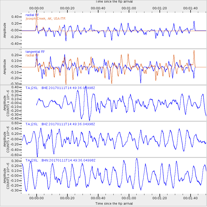
J26L Joseph Creek, AK, USA - Earthquake Result Viewer
*The percent match for this event was below the threshold and hence no stack was calculated.
| Earthquake location: |
South Of Mariana Islands |
| Earthquake latitude/longitude: |
12.2/141.1 |
| Earthquake time(UTC): |
2017/01/11 (011) 14:38:39 GMT |
| Earthquake Depth: |
10 km |
| Earthquake Magnitude: |
5.5 mb |
| Earthquake Catalog/Contributor: |
NEIC PDE/us |
|
| Network: |
TA USArray Transportable Network (new EarthScope stations) |
| Station: |
J26L Joseph Creek, AK, USA |
| Lat/Lon: |
64.50 N/143.56 W |
| Elevation: |
1144 m |
|
| Distance: |
72.7 deg |
| Az: |
26.011 deg |
| Baz: |
262.08 deg |
| Ray Param: |
$rayparam |
*The percent match for this event was below the threshold and hence was not used in the summary stack. |
|
| Radial Match: |
57.267826 % |
| Radial Bump: |
400 |
| Transverse Match: |
58.57072 % |
| Transverse Bump: |
399 |
| SOD ConfigId: |
11737051 |
| Insert Time: |
2019-04-26 14:42:33.883 +0000 |
| GWidth: |
2.5 |
| Max Bumps: |
400 |
| Tol: |
0.001 |
|
Signal To Noise
| Channel | StoN | STA | LTA |
| TA:J26L: :BHZ:20170111T14:49:36.04998Z | 2.2619724 | 2.9508064E-7 | 1.304528E-7 |
| TA:J26L: :BHN:20170111T14:49:36.04998Z | 1.0407685 | 1.2115812E-7 | 1.1641217E-7 |
| TA:J26L: :BHE:20170111T14:49:36.04998Z | 3.7041295 | 3.1486047E-7 | 8.5002554E-8 |
| Arrivals |
| Ps | |
| PpPs | |
| PsPs/PpSs | |


