You are here: Home > Network List > TA - USArray Transportable Network (new EarthScope stations) Stations List
> Station H17A Grant Village (NPS), Yellowstone Nt. Park, WY, USA > Earthquake Result Viewer
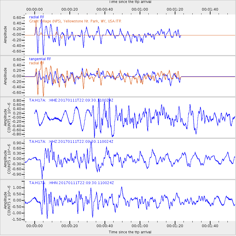
H17A Grant Village (NPS), Yellowstone Nt. Park, WY, USA - Earthquake Result Viewer
*The percent match for this event was below the threshold and hence no stack was calculated.
| Earthquake location: |
Northern Chile |
| Earthquake latitude/longitude: |
-22.8/-69.9 |
| Earthquake time(UTC): |
2017/01/11 (011) 21:58:17 GMT |
| Earthquake Depth: |
69 km |
| Earthquake Magnitude: |
5.9 Mww |
| Earthquake Catalog/Contributor: |
NEIC PDE/us |
|
| Network: |
TA USArray Transportable Network (new EarthScope stations) |
| Station: |
H17A Grant Village (NPS), Yellowstone Nt. Park, WY, USA |
| Lat/Lon: |
44.40 N/110.58 W |
| Elevation: |
2400 m |
|
| Distance: |
76.5 deg |
| Az: |
331.297 deg |
| Baz: |
141.824 deg |
| Ray Param: |
$rayparam |
*The percent match for this event was below the threshold and hence was not used in the summary stack. |
|
| Radial Match: |
56.685944 % |
| Radial Bump: |
400 |
| Transverse Match: |
67.47403 % |
| Transverse Bump: |
400 |
| SOD ConfigId: |
11737051 |
| Insert Time: |
2019-04-26 14:52:50.149 +0000 |
| GWidth: |
2.5 |
| Max Bumps: |
400 |
| Tol: |
0.001 |
|
Signal To Noise
| Channel | StoN | STA | LTA |
| TA:H17A: :HHZ:20170111T22:09:30.110024Z | 2.03702 | 3.6854829E-7 | 1.8092521E-7 |
| TA:H17A: :HHN:20170111T22:09:30.110024Z | 1.7178454 | 4.0247087E-7 | 2.3428817E-7 |
| TA:H17A: :HHE:20170111T22:09:30.110024Z | 1.484877 | 3.1004123E-7 | 2.0879928E-7 |
| Arrivals |
| Ps | |
| PpPs | |
| PsPs/PpSs | |


