You are here: Home > Network List > TA - USArray Transportable Network (new EarthScope stations) Stations List
> Station M53A WI Miller and Sons, Farmdale, OH, USA > Earthquake Result Viewer
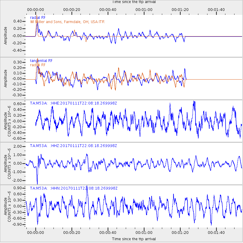
M53A WI Miller and Sons, Farmdale, OH, USA - Earthquake Result Viewer
*The percent match for this event was below the threshold and hence no stack was calculated.
| Earthquake location: |
Northern Chile |
| Earthquake latitude/longitude: |
-22.8/-69.9 |
| Earthquake time(UTC): |
2017/01/11 (011) 21:58:17 GMT |
| Earthquake Depth: |
69 km |
| Earthquake Magnitude: |
5.9 Mww |
| Earthquake Catalog/Contributor: |
NEIC PDE/us |
|
| Network: |
TA USArray Transportable Network (new EarthScope stations) |
| Station: |
M53A WI Miller and Sons, Farmdale, OH, USA |
| Lat/Lon: |
41.44 N/80.68 W |
| Elevation: |
334 m |
|
| Distance: |
64.7 deg |
| Az: |
351.071 deg |
| Baz: |
169.021 deg |
| Ray Param: |
$rayparam |
*The percent match for this event was below the threshold and hence was not used in the summary stack. |
|
| Radial Match: |
69.50401 % |
| Radial Bump: |
400 |
| Transverse Match: |
56.327248 % |
| Transverse Bump: |
400 |
| SOD ConfigId: |
11737051 |
| Insert Time: |
2019-04-26 14:52:53.595 +0000 |
| GWidth: |
2.5 |
| Max Bumps: |
400 |
| Tol: |
0.001 |
|
Signal To Noise
| Channel | StoN | STA | LTA |
| TA:M53A: :HHZ:20170111T22:08:18.269998Z | 3.0857477 | 8.0610795E-7 | 2.6123584E-7 |
| TA:M53A: :HHN:20170111T22:08:18.269998Z | 1.5695682 | 4.0939574E-7 | 2.608334E-7 |
| TA:M53A: :HHE:20170111T22:08:18.269998Z | 1.209008 | 2.406976E-7 | 1.9908686E-7 |
| Arrivals |
| Ps | |
| PpPs | |
| PsPs/PpSs | |


