You are here: Home > Network List > TA - USArray Transportable Network (new EarthScope stations) Stations List
> Station N23A Red Feather Lakes, CO, USA > Earthquake Result Viewer
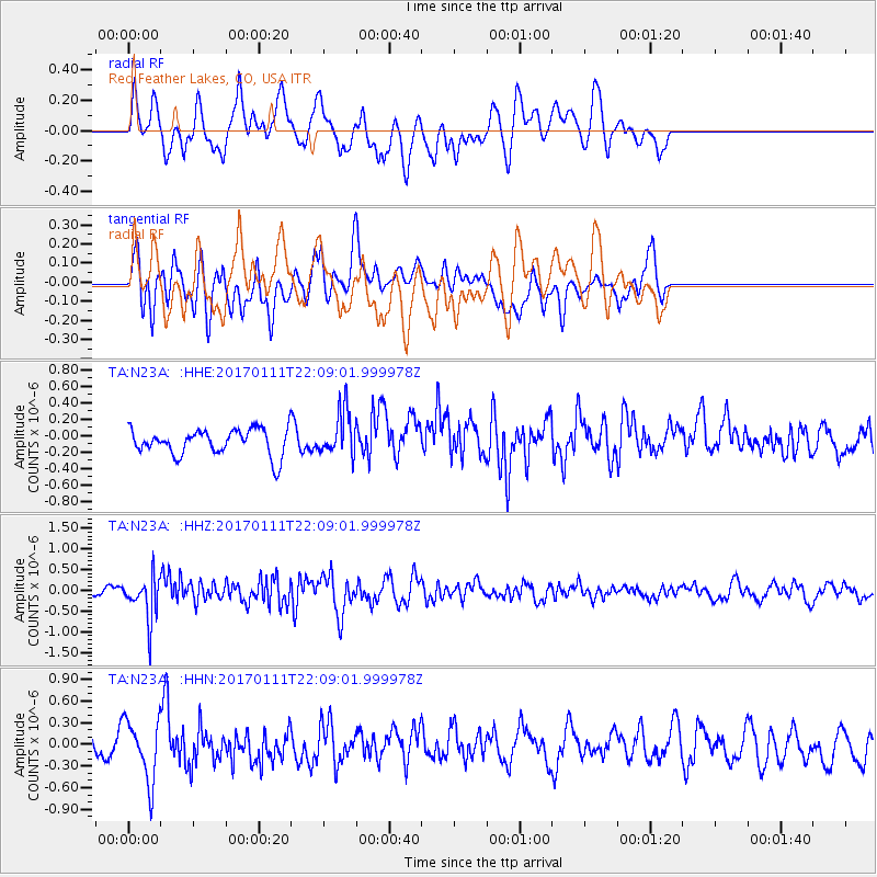
N23A Red Feather Lakes, CO, USA - Earthquake Result Viewer
*The percent match for this event was below the threshold and hence no stack was calculated.
| Earthquake location: |
Northern Chile |
| Earthquake latitude/longitude: |
-22.8/-69.9 |
| Earthquake time(UTC): |
2017/01/11 (011) 21:58:17 GMT |
| Earthquake Depth: |
69 km |
| Earthquake Magnitude: |
5.9 Mww |
| Earthquake Catalog/Contributor: |
NEIC PDE/us |
|
| Network: |
TA USArray Transportable Network (new EarthScope stations) |
| Station: |
N23A Red Feather Lakes, CO, USA |
| Lat/Lon: |
40.89 N/105.94 W |
| Elevation: |
2458 m |
|
| Distance: |
71.7 deg |
| Az: |
331.99 deg |
| Baz: |
145.143 deg |
| Ray Param: |
$rayparam |
*The percent match for this event was below the threshold and hence was not used in the summary stack. |
|
| Radial Match: |
57.113094 % |
| Radial Bump: |
400 |
| Transverse Match: |
52.7929 % |
| Transverse Bump: |
400 |
| SOD ConfigId: |
11737051 |
| Insert Time: |
2019-04-26 14:52:56.266 +0000 |
| GWidth: |
2.5 |
| Max Bumps: |
400 |
| Tol: |
0.001 |
|
Signal To Noise
| Channel | StoN | STA | LTA |
| TA:N23A: :HHZ:20170111T22:09:01.999978Z | 3.5670407 | 5.07997E-7 | 1.4241414E-7 |
| TA:N23A: :HHN:20170111T22:09:01.999978Z | 2.7712097 | 4.2838772E-7 | 1.545851E-7 |
| TA:N23A: :HHE:20170111T22:09:01.999978Z | 1.731137 | 2.6782058E-7 | 1.547079E-7 |
| Arrivals |
| Ps | |
| PpPs | |
| PsPs/PpSs | |


