You are here: Home > Network List > TA - USArray Transportable Network (new EarthScope stations) Stations List
> Station R11A Troy Canyon, Currant, NV, USA > Earthquake Result Viewer
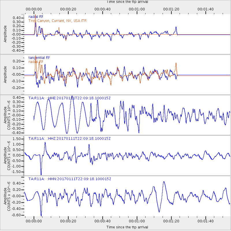
R11A Troy Canyon, Currant, NV, USA - Earthquake Result Viewer
*The percent match for this event was below the threshold and hence no stack was calculated.
| Earthquake location: |
Northern Chile |
| Earthquake latitude/longitude: |
-22.8/-69.9 |
| Earthquake time(UTC): |
2017/01/11 (011) 21:58:17 GMT |
| Earthquake Depth: |
69 km |
| Earthquake Magnitude: |
5.9 Mww |
| Earthquake Catalog/Contributor: |
NEIC PDE/us |
|
| Network: |
TA USArray Transportable Network (new EarthScope stations) |
| Station: |
R11A Troy Canyon, Currant, NV, USA |
| Lat/Lon: |
38.35 N/115.59 W |
| Elevation: |
1756 m |
|
| Distance: |
74.4 deg |
| Az: |
324.277 deg |
| Baz: |
136.758 deg |
| Ray Param: |
$rayparam |
*The percent match for this event was below the threshold and hence was not used in the summary stack. |
|
| Radial Match: |
45.871025 % |
| Radial Bump: |
400 |
| Transverse Match: |
60.27419 % |
| Transverse Bump: |
400 |
| SOD ConfigId: |
11737051 |
| Insert Time: |
2019-04-26 14:53:02.740 +0000 |
| GWidth: |
2.5 |
| Max Bumps: |
400 |
| Tol: |
0.001 |
|
Signal To Noise
| Channel | StoN | STA | LTA |
| TA:R11A: :HHZ:20170111T22:09:18.100015Z | 2.050504 | 5.3419245E-7 | 2.6051762E-7 |
| TA:R11A: :HHN:20170111T22:09:18.100015Z | 1.6240994 | 2.1867696E-7 | 1.3464505E-7 |
| TA:R11A: :HHE:20170111T22:09:18.100015Z | 0.8290038 | 1.977433E-7 | 2.3853121E-7 |
| Arrivals |
| Ps | |
| PpPs | |
| PsPs/PpSs | |


