You are here: Home > Network List > US - United States National Seismic Network Stations List
> Station HAWA Hanford, Washington, USA > Earthquake Result Viewer
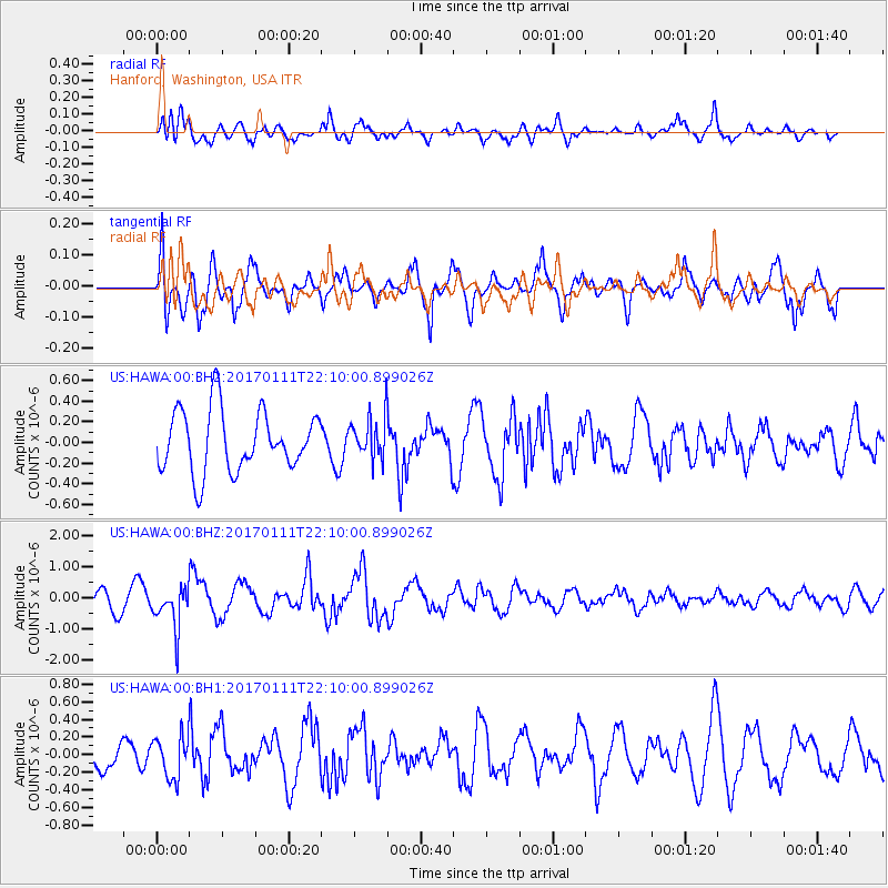
HAWA Hanford, Washington, USA - Earthquake Result Viewer
*The percent match for this event was below the threshold and hence no stack was calculated.
| Earthquake location: |
Northern Chile |
| Earthquake latitude/longitude: |
-22.8/-69.9 |
| Earthquake time(UTC): |
2017/01/11 (011) 21:58:17 GMT |
| Earthquake Depth: |
69 km |
| Earthquake Magnitude: |
5.9 Mww |
| Earthquake Catalog/Contributor: |
NEIC PDE/us |
|
| Network: |
US United States National Seismic Network |
| Station: |
HAWA Hanford, Washington, USA |
| Lat/Lon: |
46.39 N/119.53 W |
| Elevation: |
364 m |
|
| Distance: |
82.2 deg |
| Az: |
327.852 deg |
| Baz: |
134.826 deg |
| Ray Param: |
$rayparam |
*The percent match for this event was below the threshold and hence was not used in the summary stack. |
|
| Radial Match: |
54.584003 % |
| Radial Bump: |
400 |
| Transverse Match: |
53.49927 % |
| Transverse Bump: |
400 |
| SOD ConfigId: |
11737051 |
| Insert Time: |
2019-04-26 14:53:41.448 +0000 |
| GWidth: |
2.5 |
| Max Bumps: |
400 |
| Tol: |
0.001 |
|
Signal To Noise
| Channel | StoN | STA | LTA |
| US:HAWA:00:BHZ:20170111T22:10:00.899026Z | 1.6106354 | 6.6316954E-7 | 4.1174405E-7 |
| US:HAWA:00:BH1:20170111T22:10:00.899026Z | 1.7104889 | 2.3928555E-7 | 1.3989307E-7 |
| US:HAWA:00:BH2:20170111T22:10:00.899026Z | 0.50414896 | 1.4966243E-7 | 2.9686151E-7 |
| Arrivals |
| Ps | |
| PpPs | |
| PsPs/PpSs | |


