You are here: Home > Network List > CI - Caltech Regional Seismic Network Stations List
> Station VCS Vincent Substation, Palmdale, CA, USA > Earthquake Result Viewer
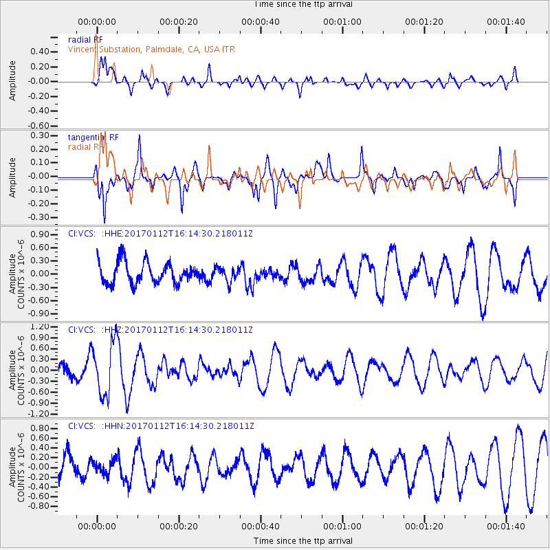
VCS Vincent Substation, Palmdale, CA, USA - Earthquake Result Viewer
*The percent match for this event was below the threshold and hence no stack was calculated.
| Earthquake location: |
Near West Coast Of Colombia |
| Earthquake latitude/longitude: |
6.1/-77.9 |
| Earthquake time(UTC): |
2017/01/12 (012) 16:06:31 GMT |
| Earthquake Depth: |
3.3 km |
| Earthquake Magnitude: |
5.5 mb |
| Earthquake Catalog/Contributor: |
NEIC PDE/us |
|
| Network: |
CI Caltech Regional Seismic Network |
| Station: |
VCS Vincent Substation, Palmdale, CA, USA |
| Lat/Lon: |
34.48 N/118.12 W |
| Elevation: |
991 m |
|
| Distance: |
46.6 deg |
| Az: |
312.846 deg |
| Baz: |
118.032 deg |
| Ray Param: |
$rayparam |
*The percent match for this event was below the threshold and hence was not used in the summary stack. |
|
| Radial Match: |
65.625786 % |
| Radial Bump: |
400 |
| Transverse Match: |
63.09339 % |
| Transverse Bump: |
400 |
| SOD ConfigId: |
11737051 |
| Insert Time: |
2019-04-26 15:02:15.919 +0000 |
| GWidth: |
2.5 |
| Max Bumps: |
400 |
| Tol: |
0.001 |
|
Signal To Noise
| Channel | StoN | STA | LTA |
| CI:VCS: :HHZ:20170112T16:14:30.218011Z | 1.9139266 | 7.411926E-7 | 3.8726282E-7 |
| CI:VCS: :HHN:20170112T16:14:30.218011Z | 0.42820117 | 1.3739216E-7 | 3.2085893E-7 |
| CI:VCS: :HHE:20170112T16:14:30.218011Z | 0.69120973 | 1.670601E-7 | 2.4169233E-7 |
| Arrivals |
| Ps | |
| PpPs | |
| PsPs/PpSs | |


