You are here: Home > Network List > TA - USArray Transportable Network (new EarthScope stations) Stations List
> Station F26K Sheenjek River, AK, USA > Earthquake Result Viewer
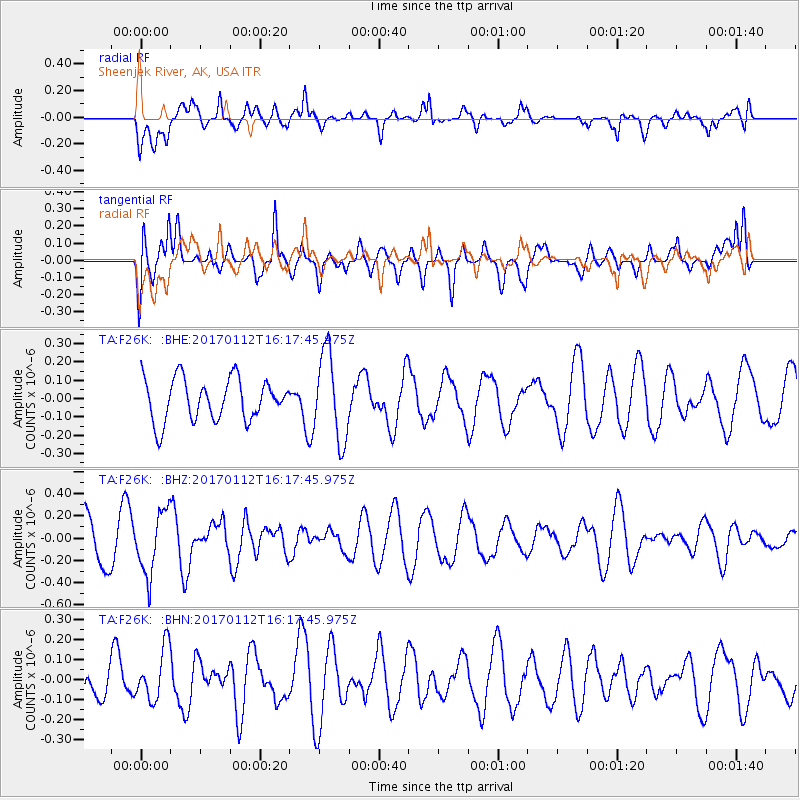
F26K Sheenjek River, AK, USA - Earthquake Result Viewer
*The percent match for this event was below the threshold and hence no stack was calculated.
| Earthquake location: |
Near West Coast Of Colombia |
| Earthquake latitude/longitude: |
6.1/-77.9 |
| Earthquake time(UTC): |
2017/01/12 (012) 16:06:31 GMT |
| Earthquake Depth: |
3.3 km |
| Earthquake Magnitude: |
5.5 mb |
| Earthquake Catalog/Contributor: |
NEIC PDE/us |
|
| Network: |
TA USArray Transportable Network (new EarthScope stations) |
| Station: |
F26K Sheenjek River, AK, USA |
| Lat/Lon: |
67.69 N/144.15 W |
| Elevation: |
683 m |
|
| Distance: |
75.5 deg |
| Az: |
338.854 deg |
| Baz: |
109.974 deg |
| Ray Param: |
$rayparam |
*The percent match for this event was below the threshold and hence was not used in the summary stack. |
|
| Radial Match: |
67.82073 % |
| Radial Bump: |
400 |
| Transverse Match: |
56.374603 % |
| Transverse Bump: |
400 |
| SOD ConfigId: |
11737051 |
| Insert Time: |
2019-04-26 15:06:49.621 +0000 |
| GWidth: |
2.5 |
| Max Bumps: |
400 |
| Tol: |
0.001 |
|
Signal To Noise
| Channel | StoN | STA | LTA |
| TA:F26K: :BHZ:20170112T16:17:45.975Z | 1.6755084 | 2.8093197E-7 | 1.676697E-7 |
| TA:F26K: :BHN:20170112T16:17:45.975Z | 0.7793167 | 1.3243964E-7 | 1.6994328E-7 |
| TA:F26K: :BHE:20170112T16:17:45.975Z | 2.0986078 | 2.3584455E-7 | 1.1238144E-7 |
| Arrivals |
| Ps | |
| PpPs | |
| PsPs/PpSs | |


