You are here: Home > Network List > UW - Pacific Northwest Regional Seismic Network Stations List
> Station MRBL Marblemount, WA, USA > Earthquake Result Viewer
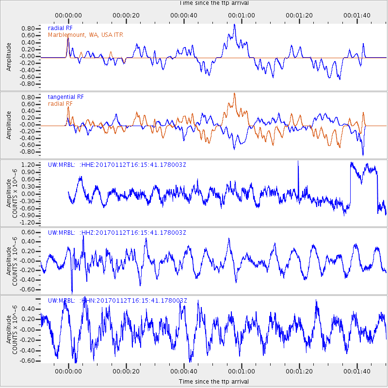
MRBL Marblemount, WA, USA - Earthquake Result Viewer
*The percent match for this event was below the threshold and hence no stack was calculated.
| Earthquake location: |
Near West Coast Of Colombia |
| Earthquake latitude/longitude: |
6.1/-77.9 |
| Earthquake time(UTC): |
2017/01/12 (012) 16:06:31 GMT |
| Earthquake Depth: |
3.3 km |
| Earthquake Magnitude: |
5.5 mb |
| Earthquake Catalog/Contributor: |
NEIC PDE/us |
|
| Network: |
UW Pacific Northwest Regional Seismic Network |
| Station: |
MRBL Marblemount, WA, USA |
| Lat/Lon: |
48.52 N/121.48 W |
| Elevation: |
75 m |
|
| Distance: |
56.1 deg |
| Az: |
326.509 deg |
| Baz: |
124.374 deg |
| Ray Param: |
$rayparam |
*The percent match for this event was below the threshold and hence was not used in the summary stack. |
|
| Radial Match: |
55.856445 % |
| Radial Bump: |
400 |
| Transverse Match: |
35.914997 % |
| Transverse Bump: |
400 |
| SOD ConfigId: |
11737051 |
| Insert Time: |
2019-04-26 15:07:47.446 +0000 |
| GWidth: |
2.5 |
| Max Bumps: |
400 |
| Tol: |
0.001 |
|
Signal To Noise
| Channel | StoN | STA | LTA |
| UW:MRBL: :HHZ:20170112T16:15:41.178003Z | 1.2805014 | 2.1607337E-7 | 1.6874124E-7 |
| UW:MRBL: :HHN:20170112T16:15:41.178003Z | 2.2067325 | 3.5623765E-7 | 1.6143218E-7 |
| UW:MRBL: :HHE:20170112T16:15:41.178003Z | 0.88022476 | 2.2015601E-7 | 2.501134E-7 |
| Arrivals |
| Ps | |
| PpPs | |
| PsPs/PpSs | |


