You are here: Home > Network List > G - GEOSCOPE Stations List
> Station WUS Wushi, Xinjiang Uygur, China > Earthquake Result Viewer
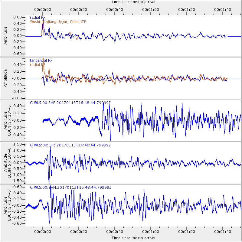
WUS Wushi, Xinjiang Uygur, China - Earthquake Result Viewer
*The percent match for this event was below the threshold and hence no stack was calculated.
| Earthquake location: |
Northern Molucca Sea |
| Earthquake latitude/longitude: |
0.0/125.1 |
| Earthquake time(UTC): |
2017/01/13 (013) 16:39:25 GMT |
| Earthquake Depth: |
46 km |
| Earthquake Magnitude: |
5.7 mb |
| Earthquake Catalog/Contributor: |
NEIC PDE/us |
|
| Network: |
G GEOSCOPE |
| Station: |
WUS Wushi, Xinjiang Uygur, China |
| Lat/Lon: |
41.20 N/79.22 E |
| Elevation: |
1457 m |
|
| Distance: |
58.3 deg |
| Az: |
320.46 deg |
| Baz: |
122.475 deg |
| Ray Param: |
$rayparam |
*The percent match for this event was below the threshold and hence was not used in the summary stack. |
|
| Radial Match: |
74.65885 % |
| Radial Bump: |
400 |
| Transverse Match: |
64.383934 % |
| Transverse Bump: |
400 |
| SOD ConfigId: |
11737051 |
| Insert Time: |
2019-04-26 15:10:29.810 +0000 |
| GWidth: |
2.5 |
| Max Bumps: |
400 |
| Tol: |
0.001 |
|
Signal To Noise
| Channel | StoN | STA | LTA |
| G:WUS:00:BHZ:20170113T16:48:44.79999Z | 7.27555 | 6.3556615E-7 | 8.735644E-8 |
| G:WUS:00:BHN:20170113T16:48:44.79999Z | 3.597721 | 2.3866738E-7 | 6.633849E-8 |
| G:WUS:00:BHE:20170113T16:48:44.79999Z | 3.7629921 | 2.292889E-7 | 6.09326E-8 |
| Arrivals |
| Ps | |
| PpPs | |
| PsPs/PpSs | |


