You are here: Home > Network List > TA - USArray Transportable Network (new EarthScope stations) Stations List
> Station G21K Allakaket, AK, USA > Earthquake Result Viewer
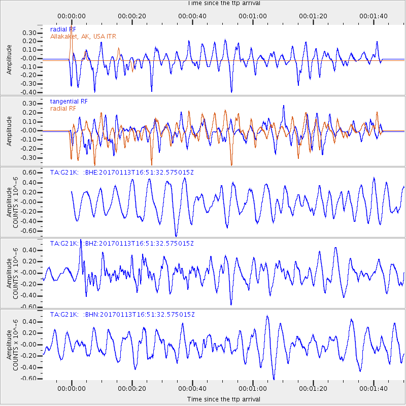
G21K Allakaket, AK, USA - Earthquake Result Viewer
*The percent match for this event was below the threshold and hence no stack was calculated.
| Earthquake location: |
Northern Molucca Sea |
| Earthquake latitude/longitude: |
0.0/125.1 |
| Earthquake time(UTC): |
2017/01/13 (013) 16:39:25 GMT |
| Earthquake Depth: |
46 km |
| Earthquake Magnitude: |
5.7 mb |
| Earthquake Catalog/Contributor: |
NEIC PDE/us |
|
| Network: |
TA USArray Transportable Network (new EarthScope stations) |
| Station: |
G21K Allakaket, AK, USA |
| Lat/Lon: |
66.52 N/153.51 W |
| Elevation: |
446 m |
|
| Distance: |
86.5 deg |
| Az: |
23.391 deg |
| Baz: |
262.15 deg |
| Ray Param: |
$rayparam |
*The percent match for this event was below the threshold and hence was not used in the summary stack. |
|
| Radial Match: |
36.91565 % |
| Radial Bump: |
388 |
| Transverse Match: |
57.919266 % |
| Transverse Bump: |
400 |
| SOD ConfigId: |
11737051 |
| Insert Time: |
2019-04-26 15:11:41.174 +0000 |
| GWidth: |
2.5 |
| Max Bumps: |
400 |
| Tol: |
0.001 |
|
Signal To Noise
| Channel | StoN | STA | LTA |
| TA:G21K: :BHZ:20170113T16:51:32.575015Z | 2.4564316 | 2.1789266E-7 | 8.870292E-8 |
| TA:G21K: :BHN:20170113T16:51:32.575015Z | 0.43188488 | 6.588488E-8 | 1.5255195E-7 |
| TA:G21K: :BHE:20170113T16:51:32.575015Z | 1.6618277 | 3.852223E-7 | 2.3180641E-7 |
| Arrivals |
| Ps | |
| PpPs | |
| PsPs/PpSs | |


