You are here: Home > Network List > GT - Global Telemetered Seismograph Network (USAF/USGS) Stations List
> Station PLCA Paso Flores, Argentina > Earthquake Result Viewer
PLCA Paso Flores, Argentina - Earthquake Result Viewer
*The percent match for this event was below the threshold and hence no stack was calculated.
| Earthquake location: |
Fiji Islands Region |
| Earthquake latitude/longitude: |
-18.6/176.2 |
| Earthquake time(UTC): |
2017/01/14 (014) 06:11:41 GMT |
| Earthquake Depth: |
10 km |
| Earthquake Magnitude: |
6.1 Mwp |
| Earthquake Catalog/Contributor: |
NEIC PDE/us |
|
| Network: |
GT Global Telemetered Seismograph Network (USAF/USGS) |
| Station: |
PLCA Paso Flores, Argentina |
| Lat/Lon: |
40.73 S/70.55 W |
| Elevation: |
1050 m |
|
| Distance: |
94.5 deg |
| Az: |
135.531 deg |
| Baz: |
240.966 deg |
| Ray Param: |
$rayparam |
*The percent match for this event was below the threshold and hence was not used in the summary stack. |
|
| Radial Match: |
67.08199 % |
| Radial Bump: |
362 |
| Transverse Match: |
47.87285 % |
| Transverse Bump: |
381 |
| SOD ConfigId: |
11737051 |
| Insert Time: |
2019-04-26 15:15:27.268 +0000 |
| GWidth: |
2.5 |
| Max Bumps: |
400 |
| Tol: |
0.001 |
|
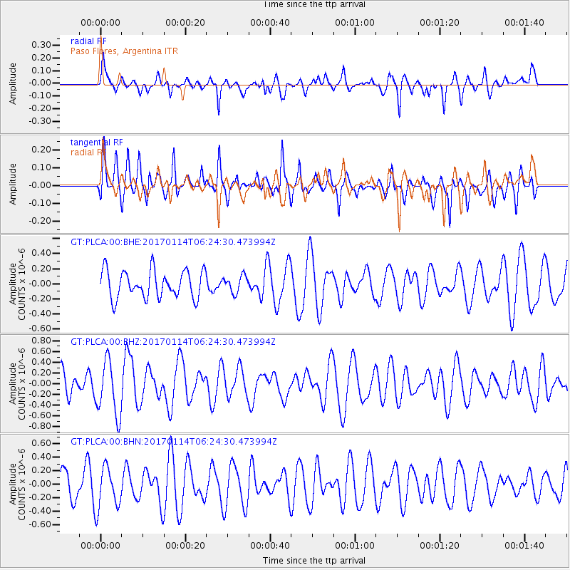
Signal To Noise
| Channel | StoN | STA | LTA |
| GT:PLCA:00:BHZ:20170114T06:24:30.473994Z | 2.8954911 | 5.173193E-7 | 1.7866375E-7 |
| GT:PLCA:00:BHN:20170114T06:24:30.473994Z | 1.3105284 | 2.9972503E-7 | 2.2870547E-7 |
| GT:PLCA:00:BHE:20170114T06:24:30.473994Z | 0.6186815 | 1.123947E-7 | 1.8166811E-7 |
| Arrivals |
| Ps | |
| PpPs | |
| PsPs/PpSs | |


