You are here: Home > Network List > UW - Pacific Northwest Regional Seismic Network Stations List
> Station BLOW Detroit Lake, OR, USA > Earthquake Result Viewer
BLOW Detroit Lake, OR, USA - Earthquake Result Viewer
*The percent match for this event was below the threshold and hence no stack was calculated.
| Earthquake location: |
Fiji Islands Region |
| Earthquake latitude/longitude: |
-18.6/176.2 |
| Earthquake time(UTC): |
2017/01/14 (014) 06:11:41 GMT |
| Earthquake Depth: |
10 km |
| Earthquake Magnitude: |
6.1 Mwp |
| Earthquake Catalog/Contributor: |
NEIC PDE/us |
|
| Network: |
UW Pacific Northwest Regional Seismic Network |
| Station: |
BLOW Detroit Lake, OR, USA |
| Lat/Lon: |
44.68 N/122.19 W |
| Elevation: |
652 m |
|
| Distance: |
84.3 deg |
| Az: |
39.092 deg |
| Baz: |
236.971 deg |
| Ray Param: |
$rayparam |
*The percent match for this event was below the threshold and hence was not used in the summary stack. |
|
| Radial Match: |
69.061554 % |
| Radial Bump: |
400 |
| Transverse Match: |
67.53964 % |
| Transverse Bump: |
400 |
| SOD ConfigId: |
11737051 |
| Insert Time: |
2019-04-26 15:17:43.764 +0000 |
| GWidth: |
2.5 |
| Max Bumps: |
400 |
| Tol: |
0.001 |
|
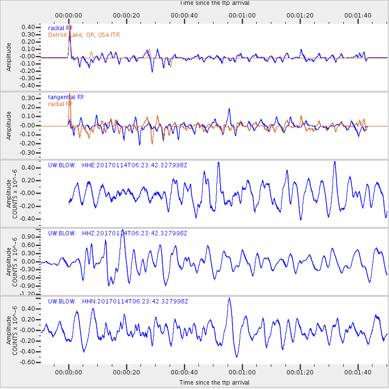
Signal To Noise
| Channel | StoN | STA | LTA |
| UW:BLOW: :HHZ:20170114T06:23:42.327998Z | 2.1769767 | 1.784455E-7 | 8.196942E-8 |
| UW:BLOW: :HHN:20170114T06:23:42.327998Z | 2.9600892 | 2.1616816E-7 | 7.302758E-8 |
| UW:BLOW: :HHE:20170114T06:23:42.327998Z | 0.8623959 | 7.9640486E-8 | 9.2347946E-8 |
| Arrivals |
| Ps | |
| PpPs | |
| PsPs/PpSs | |


