You are here: Home > Network List > AZ - ANZA Regional Network Stations List
> Station LVA2 AZ.LVA2 > Earthquake Result Viewer
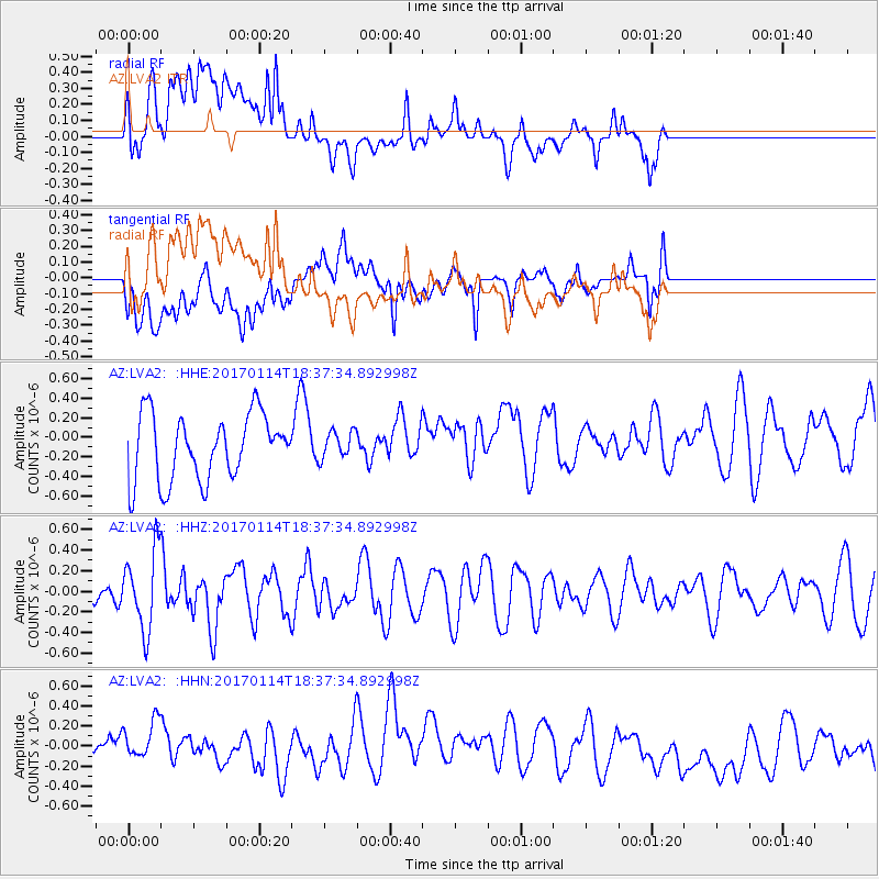
LVA2 AZ.LVA2 - Earthquake Result Viewer
*The percent match for this event was below the threshold and hence no stack was calculated.
| Earthquake location: |
Fiji Islands Region |
| Earthquake latitude/longitude: |
-18.7/176.1 |
| Earthquake time(UTC): |
2017/01/14 (014) 18:25:43 GMT |
| Earthquake Depth: |
4.6 km |
| Earthquake Magnitude: |
5.7 Mww |
| Earthquake Catalog/Contributor: |
NEIC PDE/us |
|
| Network: |
AZ ANZA Regional Network |
| Station: |
LVA2 AZ.LVA2 |
| Lat/Lon: |
33.35 N/116.56 W |
| Elevation: |
1435 m |
|
| Distance: |
82.4 deg |
| Az: |
51.19 deg |
| Baz: |
241.966 deg |
| Ray Param: |
$rayparam |
*The percent match for this event was below the threshold and hence was not used in the summary stack. |
|
| Radial Match: |
48.447018 % |
| Radial Bump: |
400 |
| Transverse Match: |
51.329403 % |
| Transverse Bump: |
400 |
| SOD ConfigId: |
11737051 |
| Insert Time: |
2019-04-26 15:25:28.916 +0000 |
| GWidth: |
2.5 |
| Max Bumps: |
400 |
| Tol: |
0.001 |
|
Signal To Noise
| Channel | StoN | STA | LTA |
| AZ:LVA2: :HHZ:20170114T18:37:34.892998Z | 2.4306552 | 3.7933373E-7 | 1.5606234E-7 |
| AZ:LVA2: :HHN:20170114T18:37:34.892998Z | 1.1470492 | 3.6465534E-7 | 3.179073E-7 |
| AZ:LVA2: :HHE:20170114T18:37:34.892998Z | 0.41810536 | 1.4144557E-7 | 3.3830125E-7 |
| Arrivals |
| Ps | |
| PpPs | |
| PsPs/PpSs | |


