You are here: Home > Network List > CI - Caltech Regional Seismic Network Stations List
> Station BFS Mt Baldy Forest Station > Earthquake Result Viewer
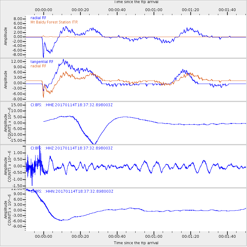
BFS Mt Baldy Forest Station - Earthquake Result Viewer
*The percent match for this event was below the threshold and hence no stack was calculated.
| Earthquake location: |
Fiji Islands Region |
| Earthquake latitude/longitude: |
-18.7/176.1 |
| Earthquake time(UTC): |
2017/01/14 (014) 18:25:43 GMT |
| Earthquake Depth: |
4.6 km |
| Earthquake Magnitude: |
5.7 Mww |
| Earthquake Catalog/Contributor: |
NEIC PDE/us |
|
| Network: |
CI Caltech Regional Seismic Network |
| Station: |
BFS Mt Baldy Forest Station |
| Lat/Lon: |
34.24 N/117.66 W |
| Elevation: |
1312 m |
|
| Distance: |
82.1 deg |
| Az: |
49.965 deg |
| Baz: |
241.193 deg |
| Ray Param: |
$rayparam |
*The percent match for this event was below the threshold and hence was not used in the summary stack. |
|
| Radial Match: |
41.82968 % |
| Radial Bump: |
400 |
| Transverse Match: |
34.108585 % |
| Transverse Bump: |
400 |
| SOD ConfigId: |
11737051 |
| Insert Time: |
2019-04-26 15:26:10.665 +0000 |
| GWidth: |
2.5 |
| Max Bumps: |
400 |
| Tol: |
0.001 |
|
Signal To Noise
| Channel | StoN | STA | LTA |
| CI:BFS: :HHZ:20170114T18:37:32.898003Z | 1.3048967 | 4.4916416E-7 | 3.4421436E-7 |
| CI:BFS: :HHN:20170114T18:37:32.898003Z | 0.395534 | 2.7799954E-6 | 7.028461E-6 |
| CI:BFS: :HHE:20170114T18:37:32.898003Z | 1.9108963 | 1.0420532E-5 | 5.453217E-6 |
| Arrivals |
| Ps | |
| PpPs | |
| PsPs/PpSs | |


